
At the bottom? The ocean of course
THE PATH OF LAS BREÑAS, EL SAUZAL
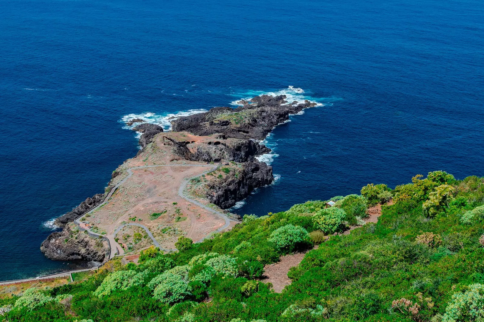
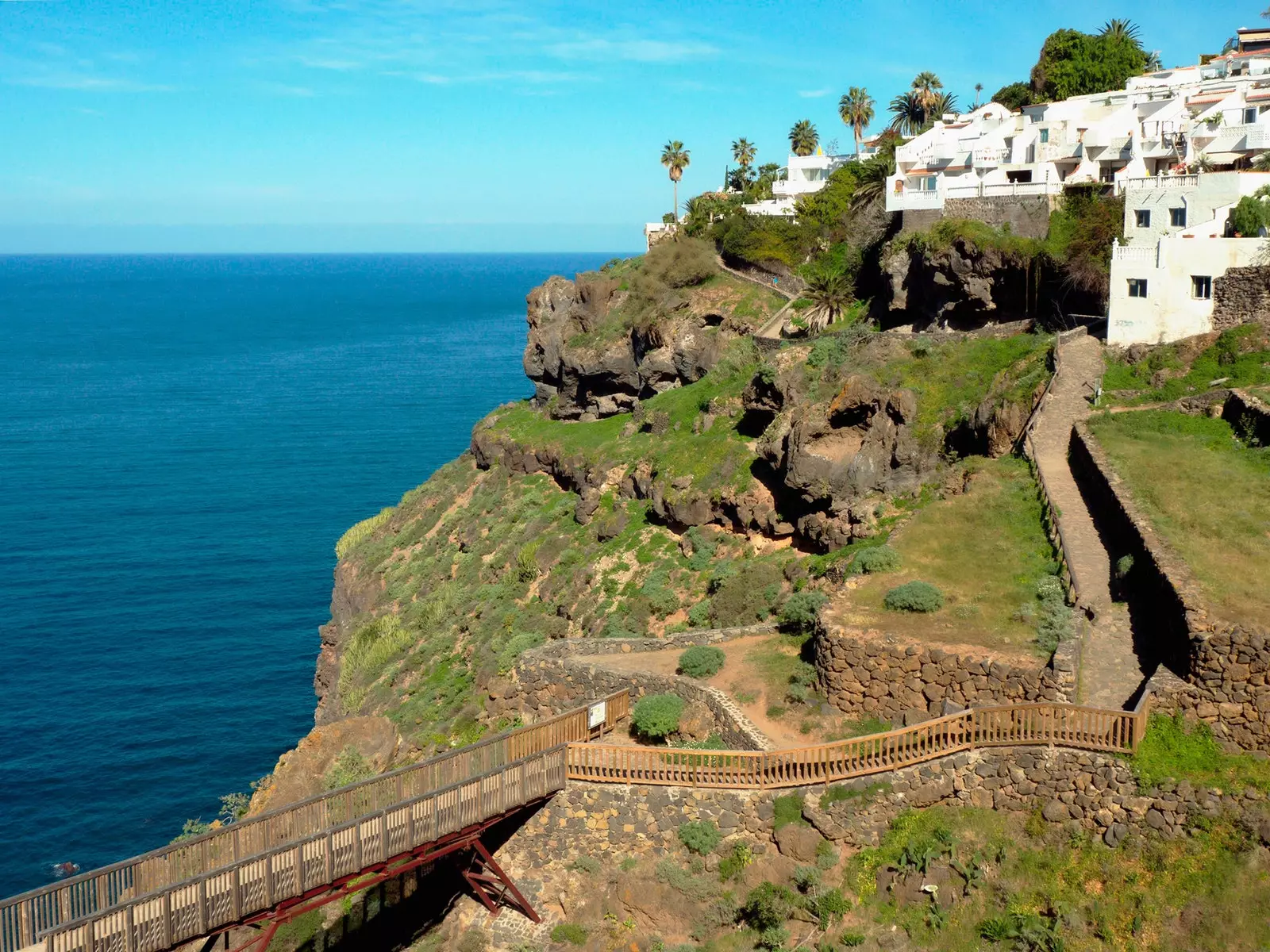
framed inside the Acentejo Coast Protected Landscape, which has an area of 401 hectares from La Orotava to Tacoronte, in the north of the island, this route begins with a main course, the viewpoint of Las Breñas. Located in El Sauzal, it offers a spectacular view of the Atlantic and the abrupt north coast of Tenerife.
Taking the path that starts from the viewpoint, the descent takes place over two kilometers where you can enjoy the native flora and fauna. Special interest has the peak of El Sauzal (Lotus maculatus), an endemic plant currently in recovery and that is only found in this place, in addition to the ubiquitous cardones, tabaibas and other species such as guaidiles. The trail is in good condition.
Panoramic view of the Breñas path
At the moment of arrival to the Punta de El Puertito, a peninsula jutting out into the ocean, it is worth stopping to feel the force of the Atlantic beating against the volcanic rock. In the beautiful nearby cove we can meet the first dip in crystal clear waters and flanked by spectacular vertical cliffs.
If you have the strength to continue walking, you can continue enjoying this beautiful coast from El Puertito, following the Paseo del Litoral Del Sauzal, that continues - yes, on flat ground - on the edge of small coves and puddles, as well as viewpoints, going through the Cangrejillo beach until you reach Rojas beach. The complete total route is just 8 kilometers and there are multiple options to cool off during it. Bringing crabs can be very useful as the coast is very rocky.
How to get
In the north of the island, on the TF-5 highway, take the detour to El Sauzal and within the town, take the Los Angeles highway (TF-1224) and follow the indications to the viewpoint of Las Breñas, located in the urbanization La Primavera. It is usually easy to find parking in the vicinity of the viewpoint.
There is also the possibility of go down by vehicle to the vicinity of Rojas beach, but the road is very narrow (two cars do not pass) and with many curves and, as if that were not enough, parking at the end of it is not guaranteed since it tends to have a high occupancy.
A very peculiar volcanic landscape that runs from Montaña Grande to the coast
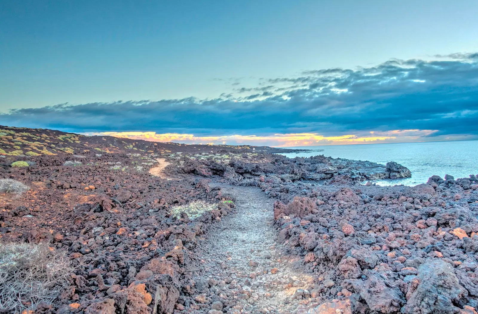
MALPAIS DE GUÍMAR, GUÍMAR
This circular walk starts from Puertito de Güímar, in the southeast of the island, and barely exceeds six kilometers, with a duration of approximately three hours. Located in the Malpaís de Güímar Special Nature Reserve, a protected area since 1987, the route allows you to enjoy a very peculiar volcanic landscape that runs from Montaña Grande, an area that was once important for grazing, to the coast.
Endemic species such as cardonales and tabaibales coexist with the impressive tubes and volcanic caves that cross the badlands, creating a landscape of immense natural beauty, with certain Jurassic airs. One of the most spectacular caves is that of Los Burros, which is 100 meters long.
After the walk, the ideal is to take a refreshing dip in Puertito de Güímar, a charming, very quiet urban beach 100 meters long, with pebbles and black sand.
How to get
You can park in the urban area of Puertito de Güímar and access the Nature Reserve from Calle Almirante Cervera.
AFUR CANYON, ANAGA
Descend the Afur ravine, Located in the surroundings of Anaga, an area of spectacular beauty where steep and very green mountains coexist with the best preserved laurel forests on the island, it has no technical difficulty and can be completed in an hour.
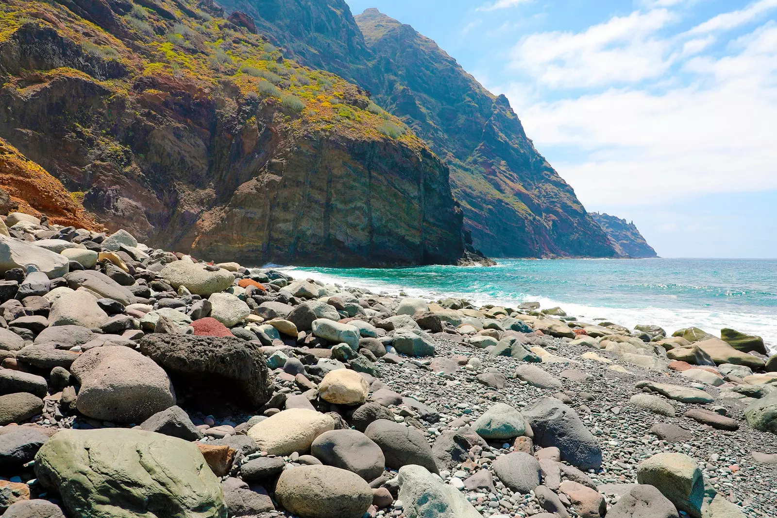
Tamadite beach, where the Afur ravine meets the sea
The tour can end in a dip for the brave who want to swim in Tamadite beach, a very beautiful and wild beach, located where the ravine meets the sea, in an enclave in which the flora of Tenerife, especially the cacti, are a real wonder. this beach, one of the most remote and isolated on the island, does not have any services and It can be dangerous due to currents.
To continue exploring the area, instead of going back up the ravine, you can complete the circular route that connects Afur with Taganana and returns to Afur, of approximately 15 kilometers. This route is well signposted, but it is worth mentioning that the route includes a cumulative drop of 1,546 meters, so it is not suitable for all audiences.
The trail runs through cliffs of impressive beauty and offers a complete panoramic view of the Anaga Rural Park, from its beautiful cliffs to its spiral peaks, in addition to the impressive vineyards and laurel forests, with the Atlantic as a backdrop.
How to get
Access to the hamlet of Afur can be done by car, for the TF-12 road that goes up from La Laguna to Las Mercedes -on the way worth doing a stop at the Mirador de la Cruz del Carmen-. In Afur there is parking.
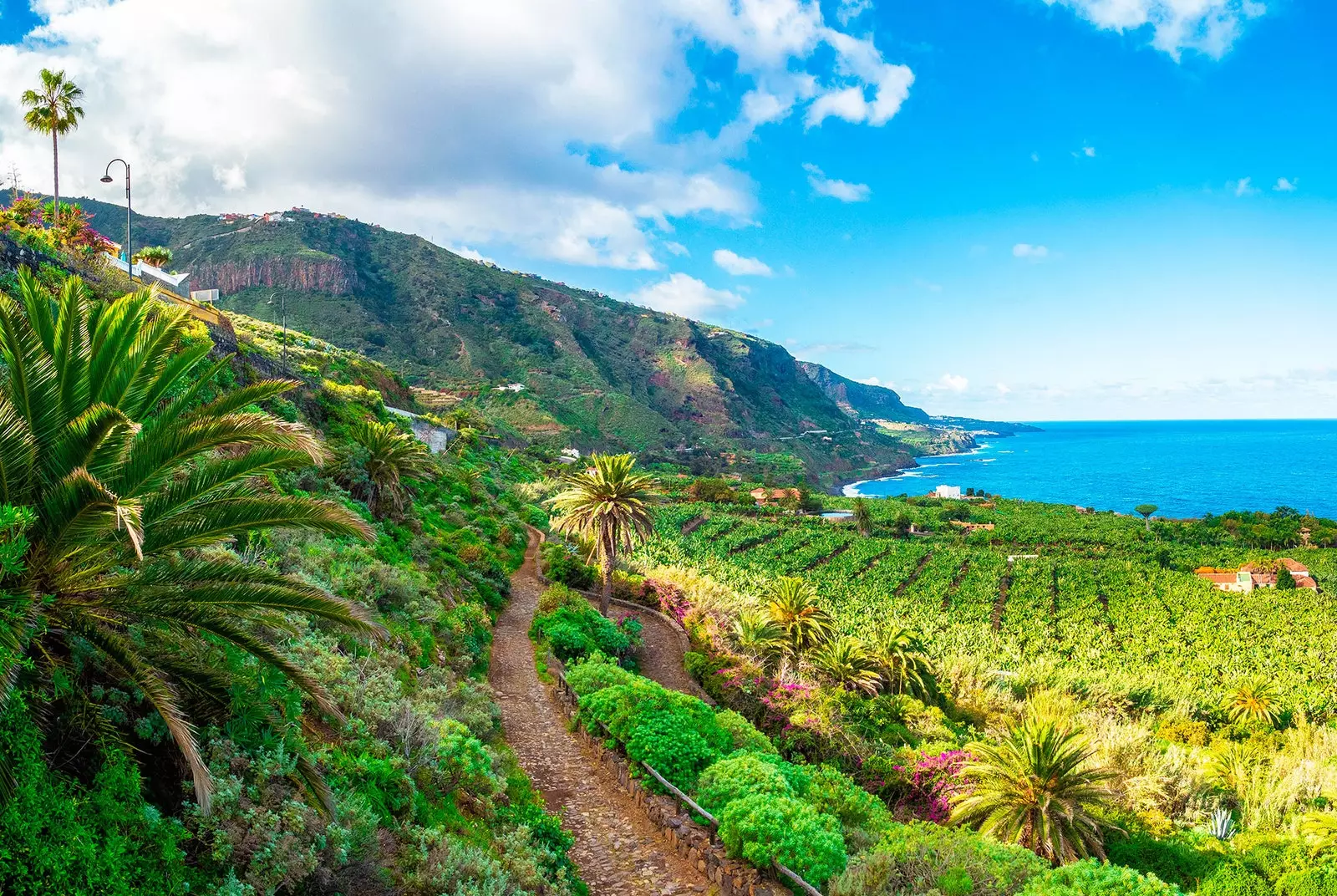
Rambla de Castro leaves incredible views of the north coast of Tenerife
RAMBLA DE CASTRO, THE REALEJOS
Located in the north of Tenerife, in the municipality of Los Realejos, this path, framed within the 45 hectares that make up the Rambla de Castro Protected Landscape, allows you to enjoy the native flora, such as the dragon trees, the Canary palm trees, the tabaibas or the cardones, in addition to the spectacular views of the north coast of Tenerife, its banana plantations and its cliffs.
One of the highlights of this tour is the Hacienda de Castro, dating from the 16th century and which preserves its architectural splendor. Depending on the course we choose for the walk, there are several alternatives to finish it. A good option is the beach of Fajana, a wild beach of black sand very beautiful and little frequented -and as such does not have any service-, or Socorro beach, very popular with surfers. The latter, with black sand and 400 meters long, is the ideal place to take a bath –with caution, as there may be strong currents- or enjoy the beach bar.
How to get
access is made from the TF-5 motorway, turning off at the San Pedro viewpoint, in Los Realejos. There is a parking lot at the beginning of the path.