
world roads
At this very moment, while you are reading this article, thousands of people are heading towards their departure gate in the airport New York , many others are preparing to embark in **the port of Barcelona** to cross the waters of the Mediterranean in cruise and some lucky ones plan their around the world by train in 56 days .
And all this is possible thanks to the great network that connects by land, sea and air every corner of the planet. Peter Atwood , a 23-year-old Canadian illustrator specializing in the creation of maps, wanted to make us aware of such immensity with five wonderful world maps in which he illustrates cities and their inhabitants, the network of railways and highways and the number of airports and ports.
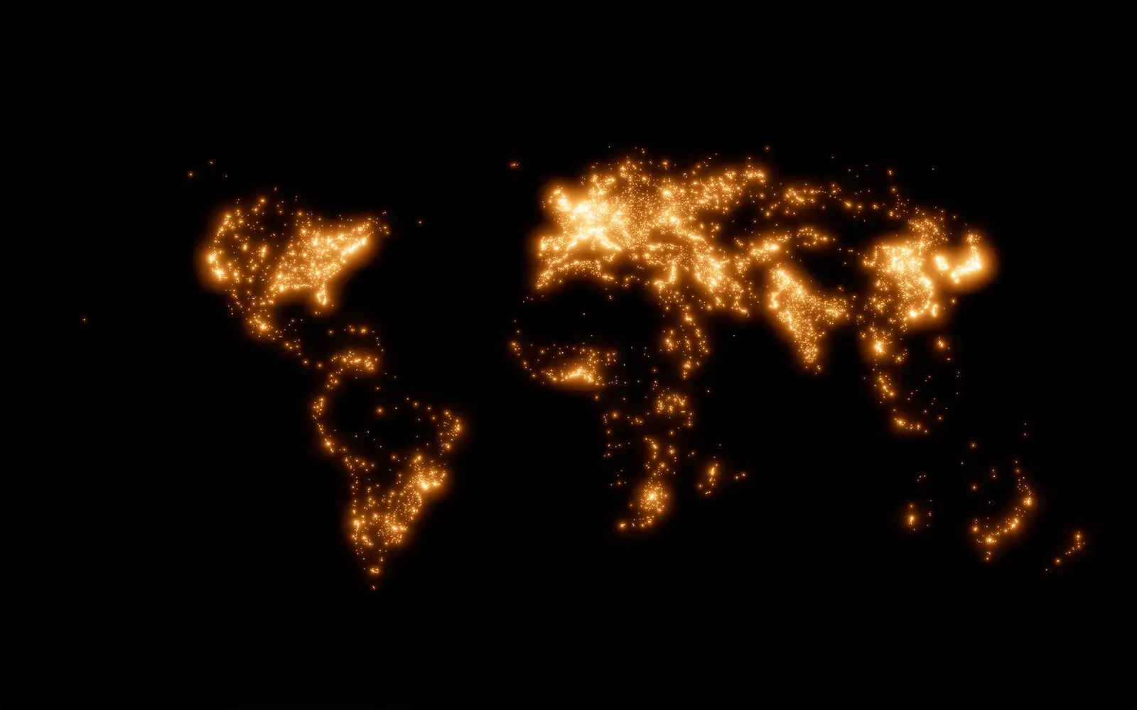
Tokyo is the most populous city
The objective of these cartographies was to show how cities have grown in the last 150 years , as well as analyze how connected we are.
“I feel that we are often overwhelmed with information and it can be difficult find patterns meaningful that make us understand the world around us. On each map I removed everything except one piece of information which I hope will allow people to find those patterns”, explains Peter Atwood to Traveler.es.
“My other goal was to develop a new technique to map the information. By making each point emit light in 3D space, areas where dots are denser appear brighter ”, he adds.
The process only took a couple of days , during which he collected the necessary data from Natural Earth Data , a public domain resource for researchers and designers, and QGIS , a geographic information system. After the exhaustive research process, he brought the information to life through blender , a 3D modeling and animation program.
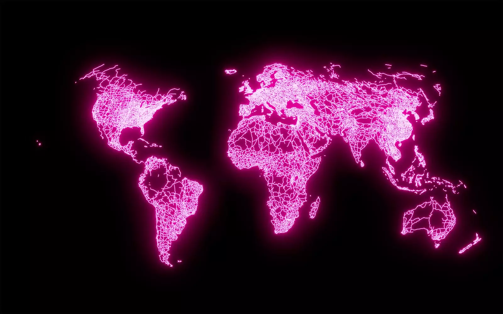
“I had to review and correct some errors in the original data. For example, **the original roadmap lacked the Darién Gap, an area between Panama and Colombia** where no roads have been built and that prevents someone from driving from North America to South America,” says Atwood.
railways
“There were also information gaps that were impossible to solve, since there is information that the countries do not include in the databases. For example, Ports along the Saint Lawrence River are listed, but inland ports on the Caspian Sea are not , since neighboring countries do not document them as such", he reveals to us.
THE MAPS
The purpose of these plans was to explain how culture and geography influence where we live and how we use the land in different ways. Atwood gives us some examples:
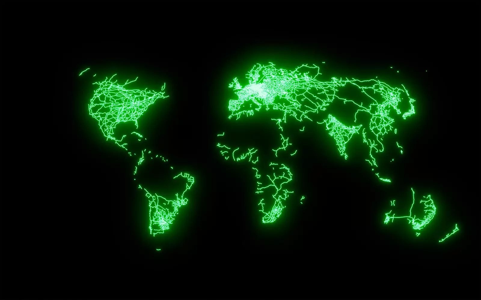
“On the railway map you can see how the Himalayas and Karakoram mountain ranges have separated India from the rest of Asia and how the railways in Africa are different from those in the rest of the world”, says the young illustrator.
“Most international railways connect cities on all continents, while in Africa most were built by colonial governments to transport materials from the interior of the continent to the coasts ”, he points out.
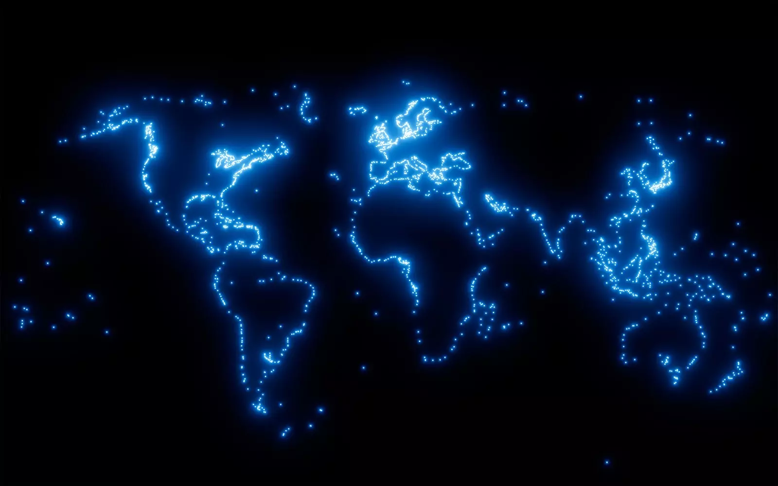
On the other hand, he was also able to see in the map of the airports that many of them cannot be accessed by road, rail or sea, since there are thousands of people who live in communities that are so isolated that they can only be reached by air.
ports
cities
What is the place in the world where more people live? One of the brightest parts of the map: tokyo . On the contrary, the deserts and jungles of Africa, South America and Australia, almost uninhabited areas, disappear completely.
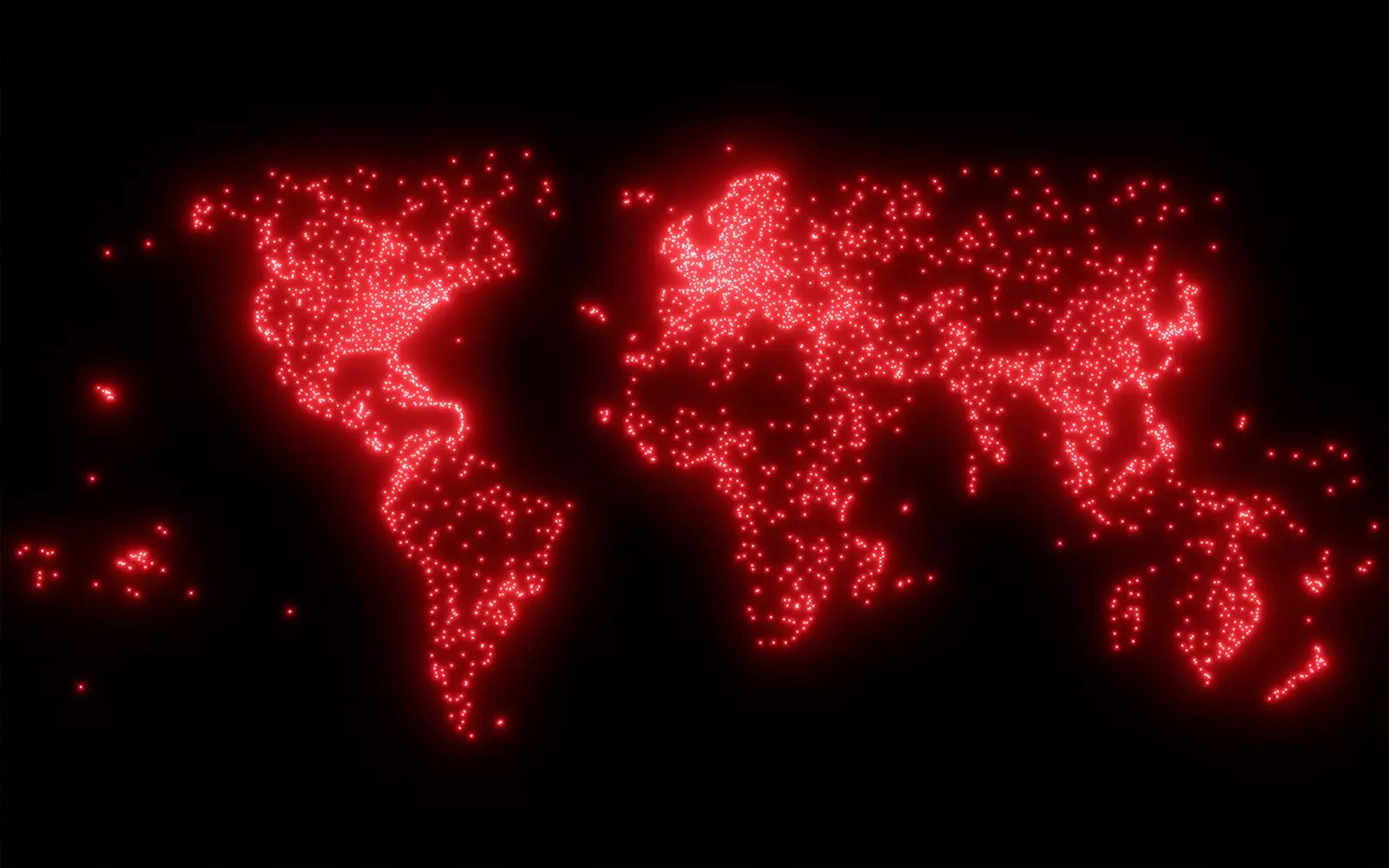
Roads
There are roads even in the most inhospitable corners of the planet, adding a total of 60 million paved kilometers. From deserts to mountains, we can find paths even in the most unimaginable enclaves.
railways
Europe it is the most resplendent continent. The reason? Its advanced network of high-speed trains , which allows us to travel almost anywhere without a car. On the other hand, in North America long-distance trains are intended mainly for freight transport. The same thing happens in Australia , where they are the longest trains in the world, with more than 500 wagons.
airports
The Amazon rainforest, the center of the Australian outback or, for example, the Canadian north are areas that are not connected to the rest of the world by road or rail. For this reason, Peter Atwood, with this map, wants let's be aware that food and supplies have to travel by plane (beyond the tourist purpose of the airports) .
airports
ports
The boats were the first way of connecting the different parts of the world, since most cities are built on the coast or on the banks of a river. This form of transportation, which has been decisive in many historical events, such as the discovery of America , continues to be key today for the transfer of goods.