
New York through its trees
The investigation started by Hubley, a computer scientist living in Brooklyn, did not bear the expected results. Shortly after starting it, he discovered that there was no census of the trees growing in Prospect Park , but instead he found out that it does exist one of the trees planted on every street in the city , they explain in Atlas Obscura. Yes, you read that right: there is a census of trees in New York and the most updated and published results to date date back to 2005.
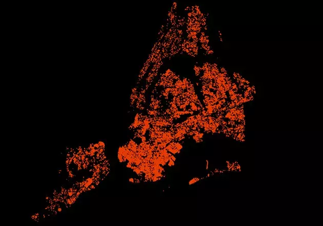
This is what the city looks like through the oak of the swamps
After analyzing data and data, Hubley came across 600,000 points to decipher and patiently capture on a map . Figure out why the Parks Department uses a four-letter code to identify each tree, but doesn't provide a dictionary to establish the relationship. And capture them with patience because he needed to develop a system that was supported by the browser.
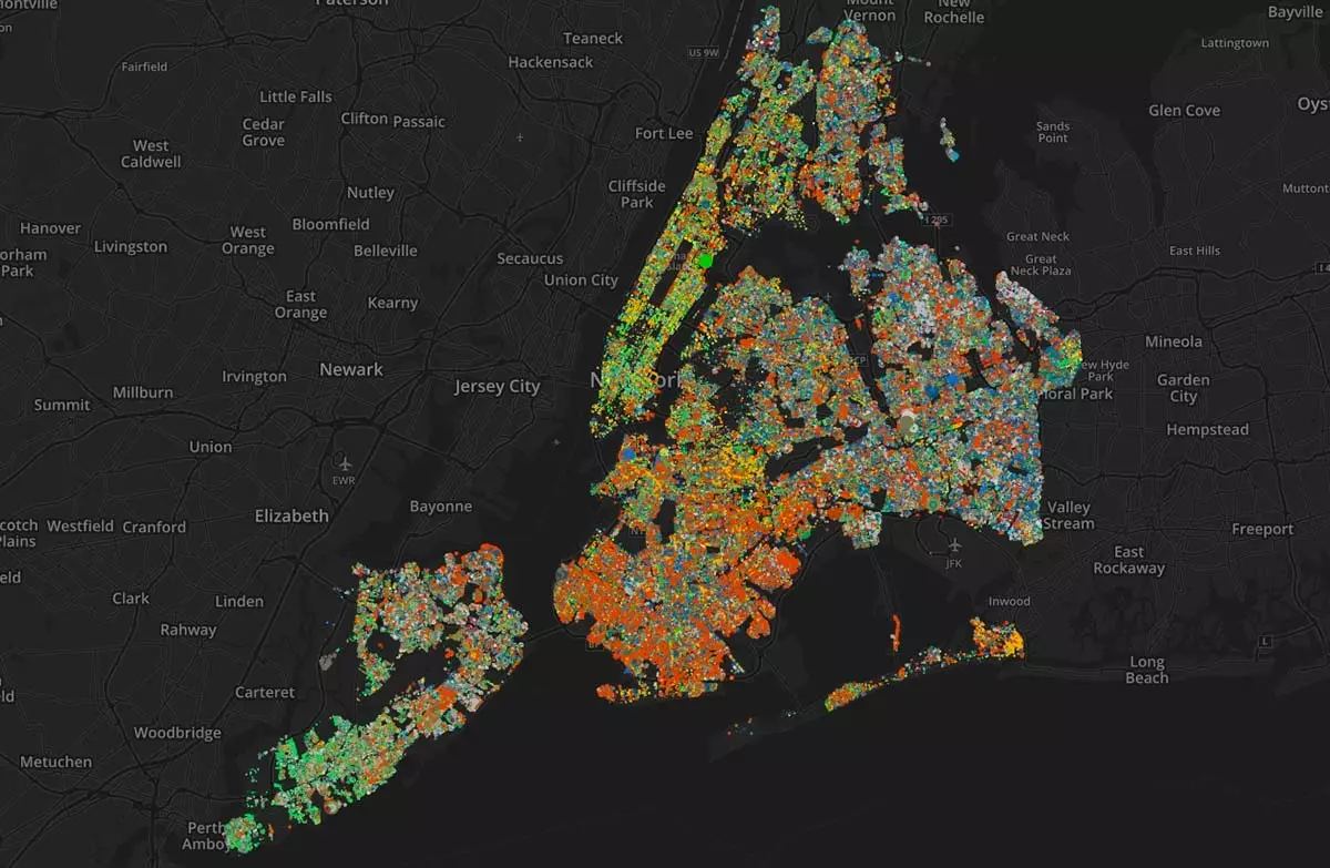
The result is **an interactive map** in which, on the one hand, you can identify the trees that grow on each and every one of the streets of the city , and on the other hand, find where a certain species grows. You can zoom in to have a more detailed view of the different neighborhoods and dispense with the base of the map (that is, the streets) to get a more abstract and artistic image.
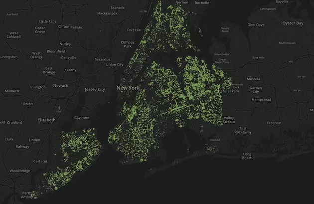
The shadow banana, one of the 'owners' of New York
In addition, from this research Hubley drew a number of conclusions about the methodology used in New York to choose where each tree is planted. Thus, for example, if there are overhead power lines on the streets, species that do not grow too large are chosen. All this, taking into account which of the 18 types of habitats identified in the city is best for the development of each kind of tree.
At the end of 2016 , the data from the last tree census, carried out last year, will be released, and the author of this clever map will update his work with them.