
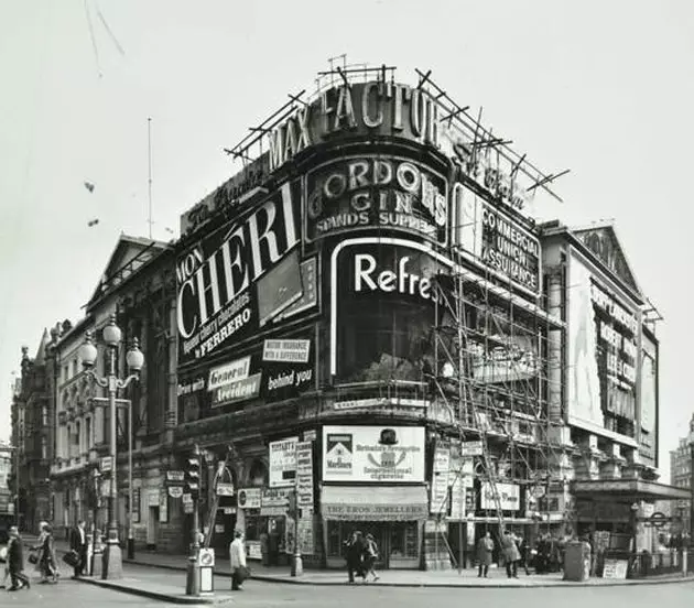
Piccadilly Circus in 1971
There are historical images , like seeing the ravages caused by the bombings of World War II. There are architectural , with which to appreciate the construction process of those monuments that fascinate us so much today. But there are also customs , scenes from the daily life of the people who inhabited this city five centuries ago, are told in Citylab . Streets that no longer exist and others that we step on in our escapades. A journey through time and history.
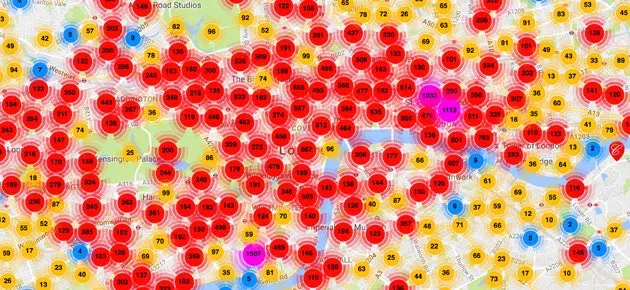
The London Picture Map is the result of **two years of work by Collage**, a society that provides free online access to more than 250,000 images that portray the city from the 15th century to the present day. **This material comes from the archives of the London Metropolitan Archive and the Guildhall Art Gallery **, they explain on the Smithsonian website. Mapping gives us wonders in the form of visual trips to the past.
A vintage Google Street View
To take a digital walk through the most vintage London, you just have to choose an area of the city on the map and, after several clicks with which you can narrow down and increase the precision of your search, you will arrive at images, paintings, drawings and posters of the area that occupies your interest.
Due to the enormous volume of material that brings together the map, from the Collage website they recommend use the search engine, entering street names and locations that appear on the map Not the one in the photos. So far (the map was released last week), the podium of the most popular searches is occupied by churches and chapels, cafes and Leicester Square.