
Because a valley is green and mountain peaks are white.
For 15 years our daily tasks have been much easier thanks to Google Maps. This navigation tool has not only taught us to take the shortest route –although this year we are more likely to drive on secondary roads–, but also He has advised us on what to do in our destination or where to eat or do the shopping.
Regarding the practical functions related to driving, it is appreciated (especially for those who usually wait for us) to be able to know the state of the traffic in real time or the place where the radars or accidents are located. eye! That from the beginning of summer in some parts of the world we can even see the red color of the traffic lights. However, this novel visualization of traffic lights is not the issue to be discussed today, but are the visual improvements that the application has just implemented which have caught our attention.
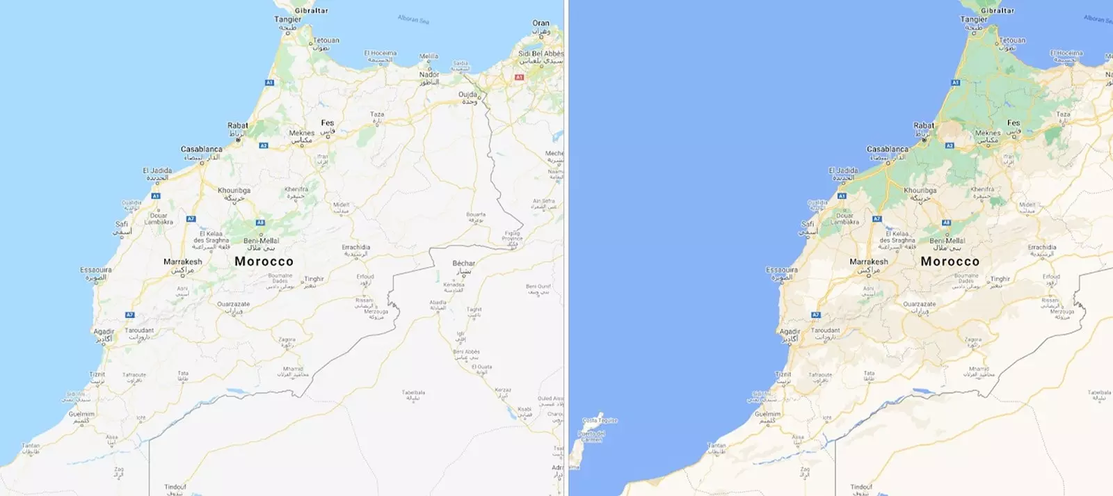
The north of Morocco is outlined as an area full of vegetation.
PRECISION AND COLOR
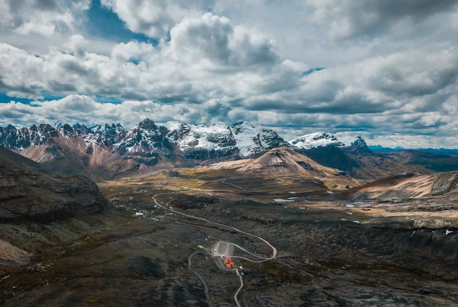
Distinguishing the snow on top of a mountain or discovering that we are in a lush forest before the vegetation hits us in the face (or, rather, on the retina) are some of the peculiarities with which Google Maps aims to surprise us and help us to understand more precisely the area that we are exploring virtually. Because seeing the natural features of a place at a glance, without having to switch to 3D Google Earth, makes our job easier, and our brain, too.
This was explained in the blog of the company Sujoy Banerjee, product manager for Google Maps, who talks about more detail and granularity thanks to a new algorithmic color mapping technique with which they can take high-definition satellite images (of 98% of the world's population) and translate them into an even more complete map and vibrant of an area on a global scale. Because a desert is not the same as a beach and the ocean has nothing to do with a lake.
Is most complete vision of the world that surrounds us covers more than 100 million km² of land on Earth – from the most populous city to the most remote town – and updating this detailed and accurate interface is available in all 220 countries and territories supported by Google Maps.
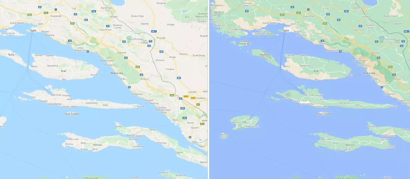
Oak, beech, pine and fern forests now color the map of Croatia.
COLORING THE WORLD
And what specific color does Google Maps assign to each region? The first thing they do –using artificial vision or computer vision– is identify in your satellite images the natural features (mountains, forests, ice sheets, etc.) and then analyze them to then assign them a range of colors according to the HSV color model (from English Hue, Saturation, Value – Hue, Saturation, Value). Geometry, statistics and physics, among other disciplines, thus achieve computers can perceive and understand an image, in the same way that our brain helps us to process the information perceived through the eyes.
"For example, a densely covered forest can be classified as dark green, while an area of irregular bushes could appear with a lighter shade of green,” says Sujoy Banerjee.
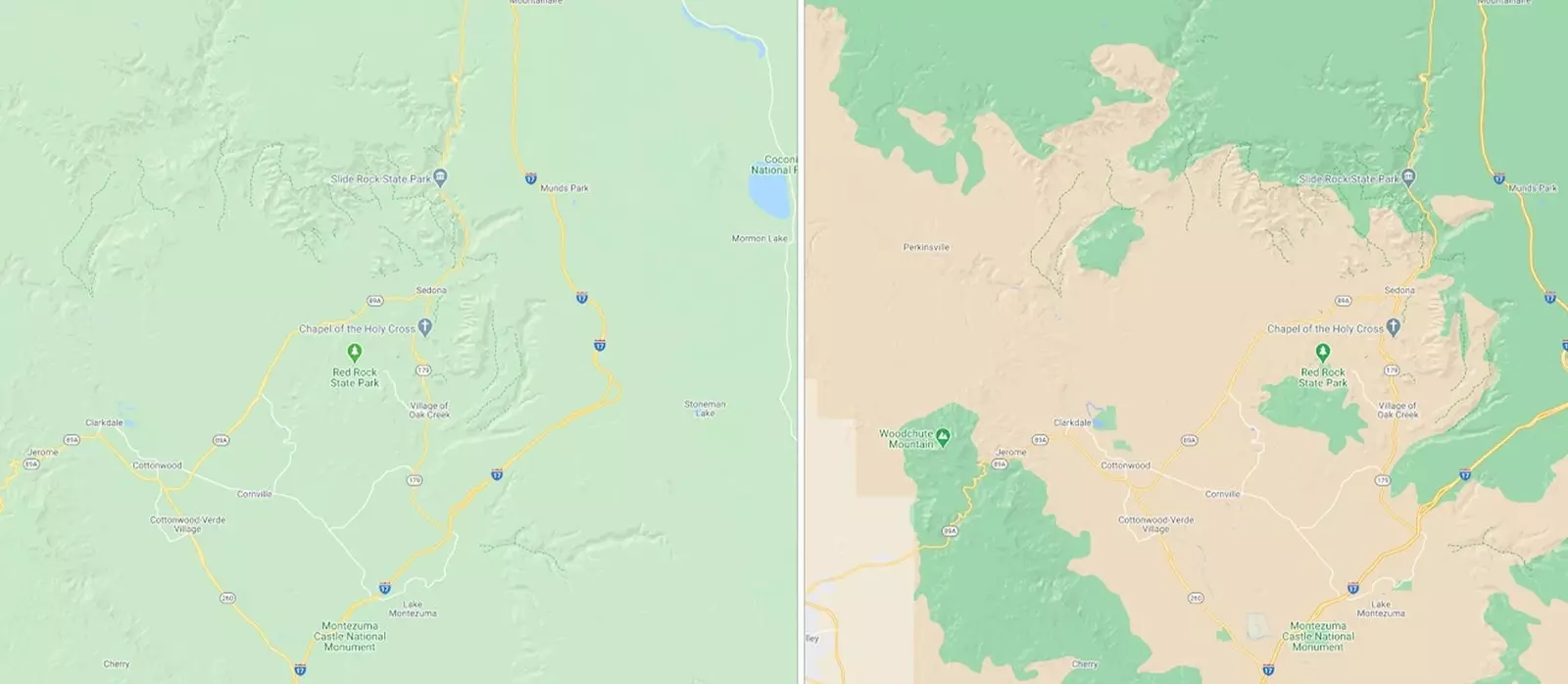
In Sedona, it's now easier to see the arid parts of the Arizona desert.
EFFICIENCY AND MOVEMENT
As revealed by the company's product manager on the blog, They are also preparing a more detailed view of cities so that pedestrians are able to move more efficiently. through its streets: they will know the precise shape and size and to scale of roads and sidewalks and even where the zebra crossings are located. Crucial information for people with accessibility needs or simply for those who walk with a baby stroller.
To have these advances and cartographic improvements in our cities, For now, we will have to wait a bit, as they will start testing them over the next few months on the maps of London, New York and San Francisco.
SUBSCRIBE HERE to our newsletter and receive all the news from Condé Nast Traveler #YoSoyTraveler

Thanks to Google Maps, pedestrians will be able to move more efficiently through cities.