

The murder map of medieval London.
To understand this map we have to situate ourselves in the London of Queen Elizabeth I, Long before jack the ripper will arrive in the city in 1888 and that some of the crimes that affected the city during the 21st century and that forged many legends will take place. Specifically, we do it in the fourteenth century.
Although it may seem strange It was not a lawless city and it was not excessively violent either, in fact there are not many documented indications that there were robberies with violence, kidnappings, scams or wars between clans. But life in the city was hard nonetheless as documented by the map created by the University of Cambridge and its Violence Research Center in 2018.
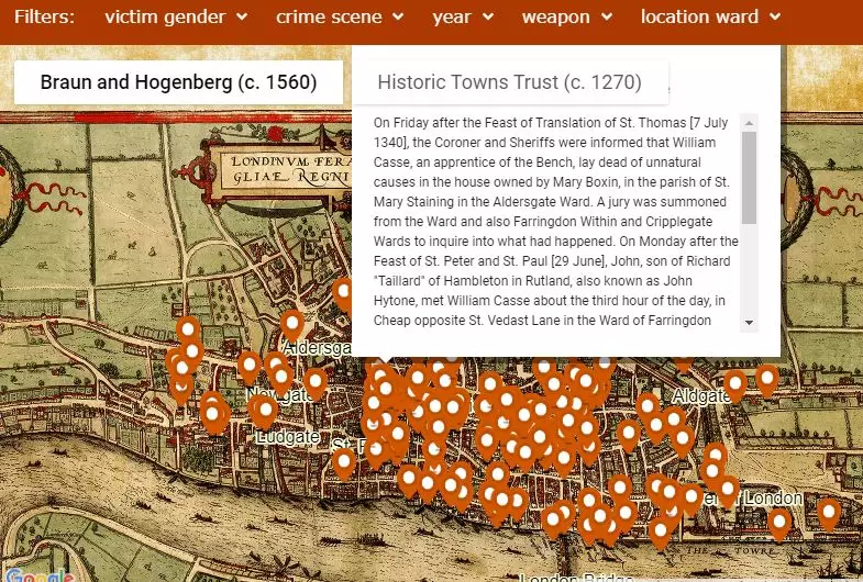
The map, which has been documented thanks to the so-called **'The Coroner's Rolls'**, documents from the forensics of the time , who are not the same coroners as now, obviously, but rather they were Crown officials who tried to clarify the murders or events that occurred. In addition, they have been helped by museum of london and of The History of London to supplement the final data.
The map shows each of the documented events.
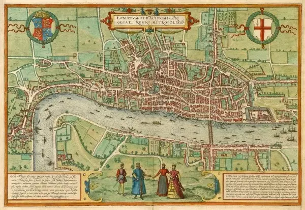
The map, which goes from 1300 to 1339, can be interpreted in two different versions: that of Braun-Hogenberg of 1572 which offers a historical view of Elizabethan London before the start of urban growth. “The map was made more than 200 years after the coroner's records were written. However, the size of the built-up area, the shape of the streets, the walls and the location of the parish churches were still very similar to those of the early fourteenth century ”, they point out from the University.
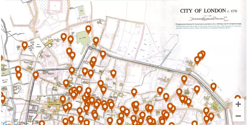
And the second map belongs to London of 1270 published by the Historic Towns Trust in 1989, providing rich details of the town's topography. “ Sometimes the location was very specific : for example, the murder of Christina de Mestre in the churchyard of St. Mary of Wolcherchehawe in the Walebrok ward in 1300 can be very precisely located outside the parish church of St. Mary Woolchurch Haw”, but it could not always be so, they emphasize.
Both maps present different filters to know the murders. We can select them according to sex, year, murder weapon, place where they were committed and even the locations where they occurred.
Also, it is possible to know the exact details by hovering over the cursor . All this is thanks to the fact that each story was recorded in the investigations carried out by the forensic experts, always in the presence of an investigative jury.
The map of London in 1300.
WHAT LONDON WAS LIKE IN THE 14TH CENTURY
The London of 1300 had a population of around 80,000 people approximately , living the majority in the north of the Thames. The city was already one of the most important in Europe and one of the most populated.
was divided into 24 districts within the wall where self-governments operated, which were already strong at the time. Forensics could work outside and inside the walls.
If we look at the map we can see that most murders happen within the most crowded areas such as markets and squares, in fact suppose 52% of the cases on the map.
According to data from the University of Cambridge, many of these altercations occurred among some of the main unions such as goldsmiths, carpenters, bakers, tailors etc. and curiously also between lawyers.
“To the west of Ludgate were the four court inns, the buildings where barristers practiced their profession and law students were trained. Several cases of homicide in the fourteenth century involved law students.
The Historic Towns Trust map.
Was medieval London then violent? As the Cambridge researchers say, not as much as might be expected. The map records 142 cases of homicide committed within the London city limits.
The number fluctuated between 13 and 22 cases per year, with an annual average of 16 cases. “If we accept a population of about 80,000 (within the walls), the murder rate in London works out to be about 20 per 100,000 people per year. This is roughly 15-20 times more than we would expect in a UK city of equal size in our day, but much lower than rates currently found in some of the world's most violent cities ”, they explain.
Most of the events that were perpetuated occurred weekends especially on Sunday at hours without light Y with knives or swords , since firearms began to be used later. Most of the deaths occurred from blows to the head.
The map also points out that 92% of the perpetrators were men and 8% women. Interestingly, they used to occur between groups of people, relatives, acquaintances, neighbors or members of the same guild.
For example: "On the night of a day in November 1325, 12 goldsmiths guild men walked down Cheapside waiting to beat up members of the Saddlers Guild because of a dispute that had arisen between the two guilds. In an outburst of violence, several men attacked a Saddlers Guild member John de Vyse, one hitting him with a sword, another nearly cutting off his leg with an axe, and the third hitting him with a cane as he lay on the pavement. ".
You can learn more information here.