

Welcome to fun Barcelona
The They Draw & Travel (TDAT) website was created in 2011 by designers and illustrators Nate Padavick and Salli S. Swindell as a place where share the wanderlust through illustration , they explain on the page. Its extensive collection is the result of the work of artists, both illustration professionals and amateurs, who have traveled the world, a lot of the world.
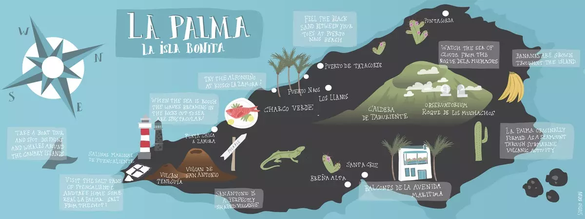
The Palm
**To find a map, you can go to the Find a map tab**, where you have different fields to search: region, type of trip, artist, illustration style and keywords. **The other option is through the Map tab**, where a world map appears with information on the number of maps available in each region. You just have to use the zoom as you would in Google Maps to get to the city you are interested in having a map of.

Madrid and its Fuencarral street

Marrakesh
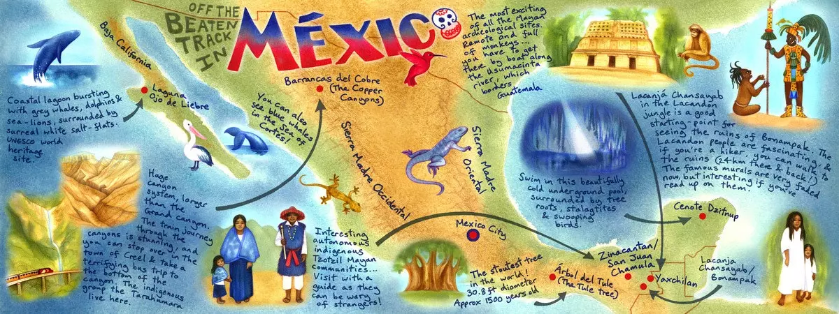
Mexico
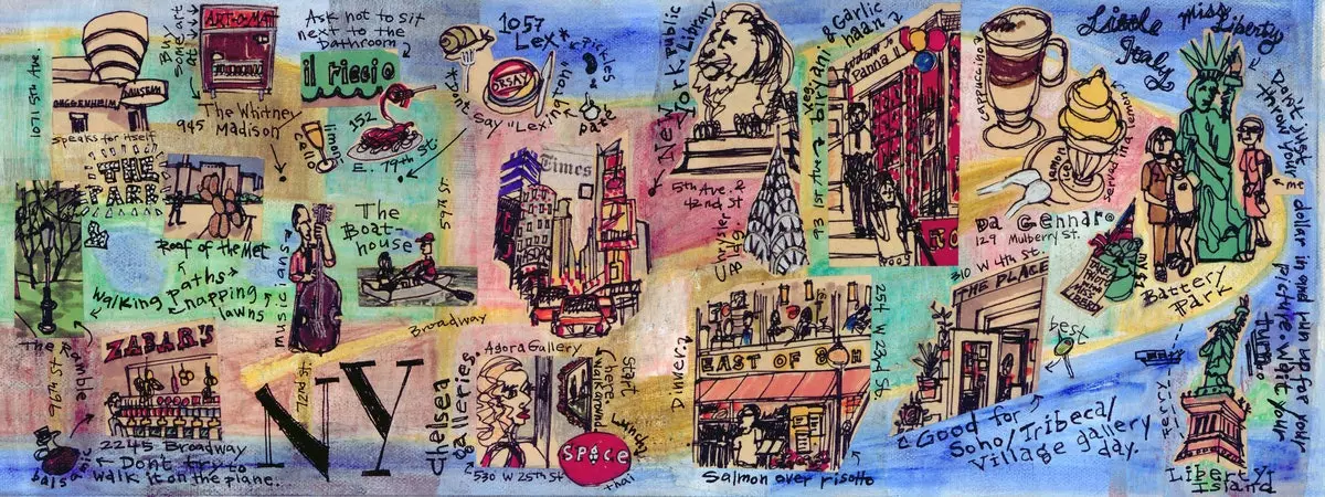
New York, New York

London, Soho

tokyo