
Walker, Asturias awaits you
It is undeniable: the Mother Nature she did not treat all her children equally when she decided to bless them with her precious gifts. Asturias proved to be part of that group of land regions that were her right eye.
That alone would explain why, in a territory that occupies little more than 2% of the surface of Spain , concentrate so many steep and imposing mountains, crystal clear lakes, fresh rivers, wild beaches and cliffs , dense and leafy forests, and extensive valleys covered by grass green rugs in which the stone mansions sink their roots, oblivious to the passage of time.
Asturias: nature in its purest state
For all this, Asturias is a land that must be traveled on foot, without haste and with the humility and respect that this magnificent work of nature deserves.
Among so much beauty, the walker will find it difficult to choose which ones are the best hiking routes in Asturias. No problem: whatever the choice, it is impossible to go wrong.
Here are some magnificent Asturian scenic trails that are suitable for all audiences.
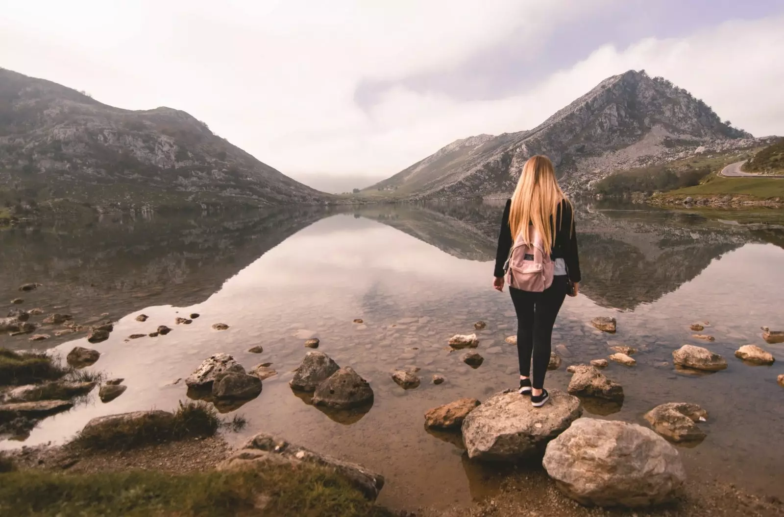
SALIENCIA LAKES ROUTE, SOMIEDO NATURAL PARK
The circular route of Saliencia lakes is much more than a simple walk in nature, as it pierces ancient mountains in which the icy and unfathomable glacial lake waters reflect the history and tradition of an entire people, and of a way of life, that resist disappearing, engulfed by the passage of time and technological advances.
In the route of just over 8 km - which can be considerably lengthened if you take different branches of the main path - four lakes -La Cueva, Calabazosa (the largest and most beautiful), Cerveriz and Almagrera (also known as La Mina)- hidden between the folds of the wild landscape that make up the Los Albos massif.
The color scheme blue, green, ocher, reddish and gray they compose a vision that seems to come from the palette of a mad painter. Path of the extension of the route that leads to contemplate the magnificent valley lake It is not strange to come across a shepherd who leads his sheep to the best pastures , which they often have to share with the ubiquitous cows.
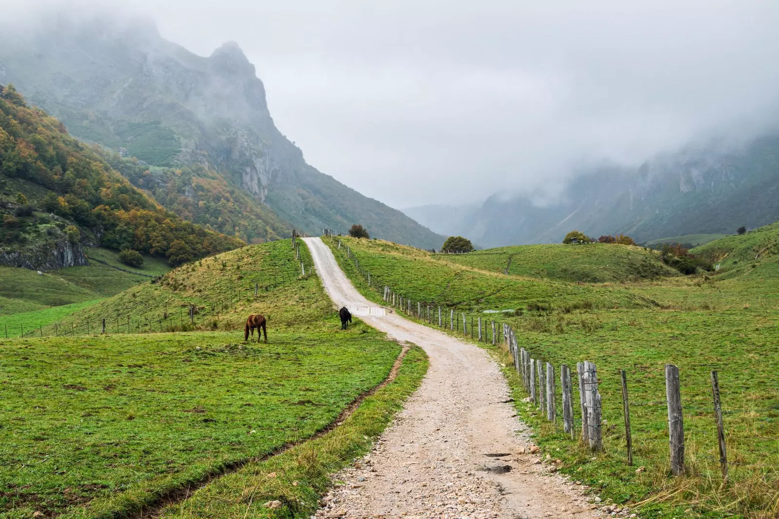
Trails in Somiedo
Alongside them, like a symbol of another age, the stubborn teitos -stone or wood constructions with black broom roofs or other bushes- are still standing, being used as haystacks or to keep livestock.
As night falls, it's time for the wild boars, wild cats, genets or bears , who go out to claim a territory that was always theirs, enjoying a splendid land bathed in the moon.
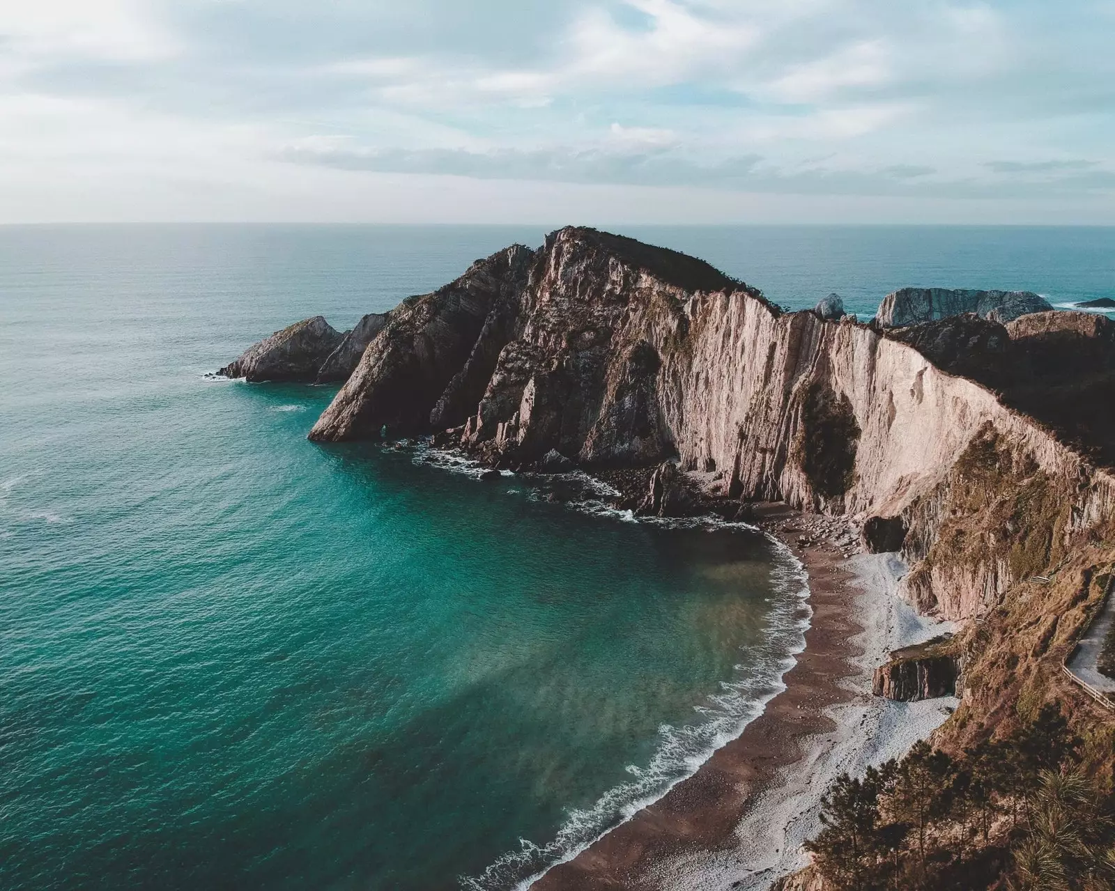
MUROS DEL NALÓN COASTAL PATH
It is not the moon, but the Cantabrian waters those that bathe, sometimes with great fury, the wild and unspoiled beaches of the dramatic coastline Asturian.
One of the simplest and most complete routes to admire the magnificent west coast of Asturias is the Coastal Path of Muros del Nalón, known as the 'Route of the Viewpoints'.
The trail connects the town of San Esteban de Pravia -formerly the most important coal port in Spain- with the Aguilar beach. It's about a linear layout of about 5 kilometers, which only presents some steep slopes at the beginning and end of the route. The visual reward to that little physical effort it is completely disproportionate.
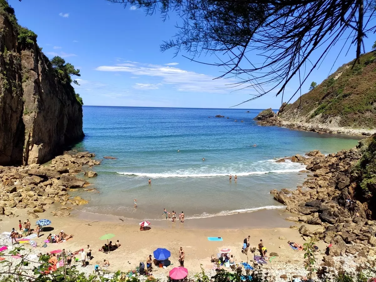
Xilo Beach
The Route of the Viewpoints runs through groves dotted with observation points -such as those of Holy Spirit, La Atalaya and Los Glayo- that open onto cliffs covered in green, among which they settle, as best they can, magnificent golden sand beaches.
You can access these beaches, so the route becomes a great full day excursion , in which they alternate bathing, diving and walks.
Following the path from east to west, the outstanding beaches are those of Losses -very extensive and located next to San Esteban de Pravia-, The Watchtower, Cazonera, Las Llanas, Xilo -a beautiful cove sandwiched between two impressive cliffs- and finally Aguilar , the most touristic of all, as it has a car park a few meters from the sand.
If it is done in summer, they cannot miss water, sunscreen and diving goggles , because under the sea surface the beauty is almost as striking as the one found on it.
THE PATH OF THE BEAR
And if the fish are the owners of the Asturian seabed, there was a time when the bears roamed freely on the slopes and valleys of the Asturian mountains.
Today, however, the cantabrian brown bear -one of the smallest subspecies of brown bear in the world, but which can boast of being the largest land animal of the Iberian fauna in the wild-, deprived of part of its natural habitat fight for your survival.
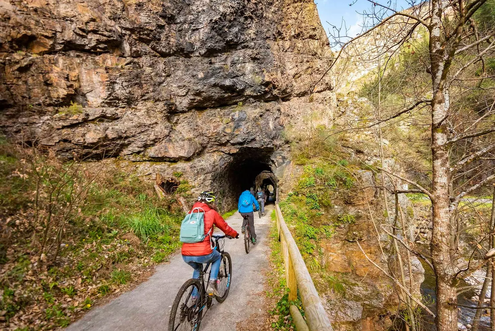
Bear Trail
In the Bear Trail can be admired the bears Paca and Molina, that are cared for at all times by the workers of the Fundación Oso de Asturias.
For them, this route has that name, but in reality the layout is nothing more than the replica of the route that carried the railway that, in the XIX century , served for transport the coal from the towns of Teverga and Proaza to Trubia.
About a hundred years after its inauguration, the road fell into disuse and was dismantled, becoming a perfect path for walkers and cyclists.
Most of the hikers leave from the small town of Tuñón, from where there are some 20 kilometers to Entrago and 26 kilometers, taking a different detour, to Santa Marina.
Enchanting wait on the road mountain towns -such as Villanueva-, narrow gorges, lonely farmhouses, the Valdemurio reservoir , the crazy course of trubia river , bridges, tunnels excavated in the imposing rocky walls and a dense and varied vegetation that allows an intimate connection with nature.
CARES ROUTE
A river and a deep gorge are also the protagonists of one of the best-known hiking routes in Asturias: the Route of Cares , in the beautiful and intriguing Picos de Europa.
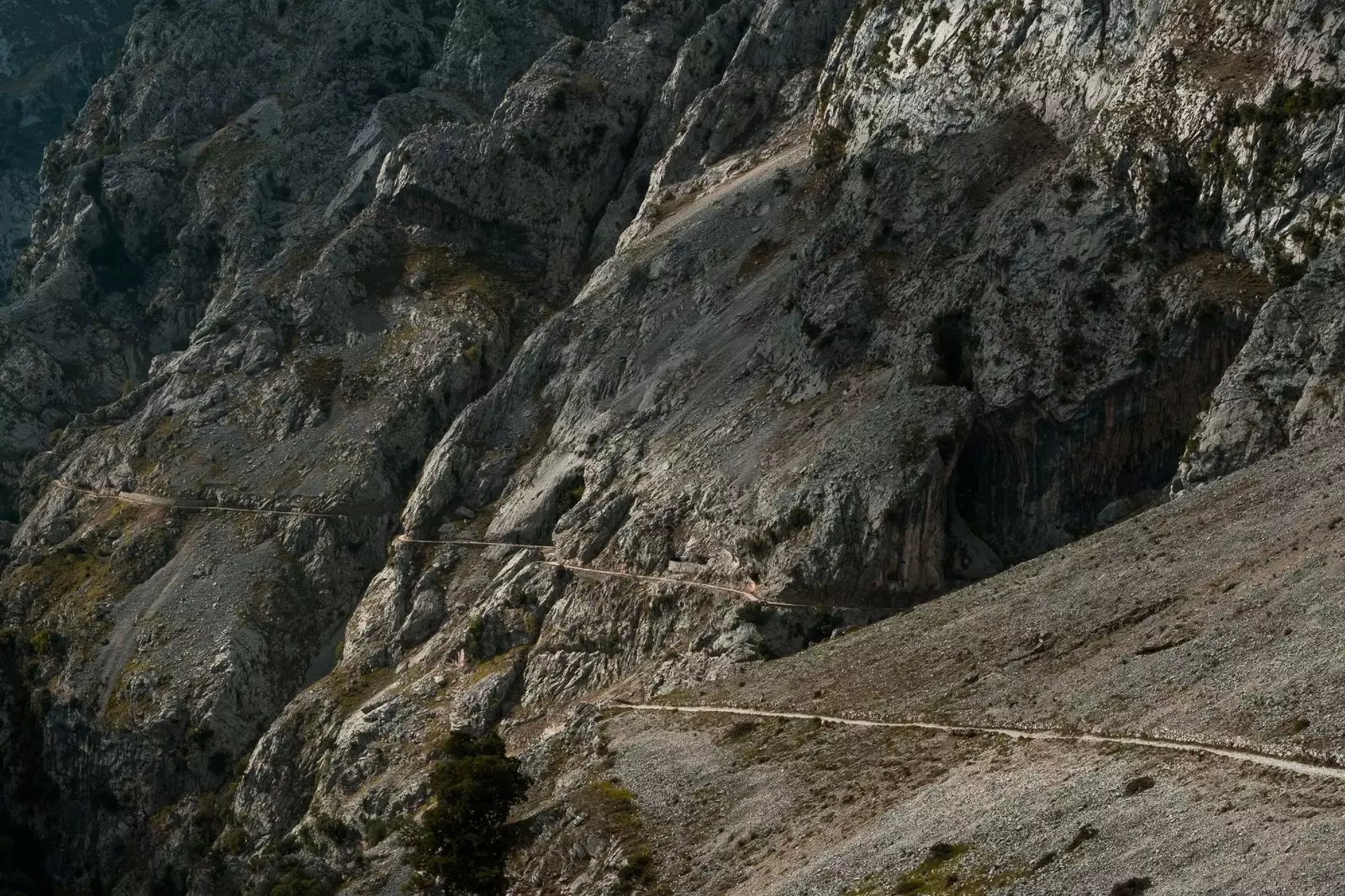
Route of Cares
Due to its great popularity, it is better to follow this mythical border path that joins the towns of Cain de Valdeon (Leon) and Poncebos (Asturias) outside the summer season, when the influx of hikers it is too high.
this spectacular 12 kilometer road has its origin in the hard work of the more than 500 men who, in the middle of the last century, managed to improve the ancient and precarious path that allowed workers access to the Poncebos hydroelectric plant.
The Route of Cares can be started of both Poncebos and Cain. Starting from Poncebos, at the beginning there is an imposing slope, but afterwards the whole road is completely flat, going through tunnels, some bridges and footbridges , and, above all, offering unrivaled views of the gorge along the bottom of which run the clear waters of the Cares River.
When doing the route first thing in the morning, it is easier to fully enjoy the landscape, being the mountain goats the only companions.
From their privileged viewpoints , located in impossible places of the steep rock walls , those goats contemplate their kingdom with the gaze of one who knows that it will never be conquered. And that's how she wanted it Mother Nature when she declared her eternal love for the Asturian land.