
Tongariro Alpine Crossing: one of the best day treks in the world
In the center of North Island of New Zealand, rises a land of volcanoes and colored lagoons whose natural beauty can only be matched by the cultural and religious significance that it has for the Maori, original inhabitants of the two islands that make up the country. A path of some 20 kilometers of route delves into the secrets of Tongariro National Park.
Speaking of day walks through this vast world that Mother Nature has bequeathed to human beings, it is very difficult to find one more impressive than the one that the most beautiful section of the Tongariro National Park.
the shocking lunar aspect presenting the land surrounding the three volcanoes – Tongariro, Ngauruhoe and Ruapehu – reigning over New Zealand's oldest national park, inspired New Zealand film director, Peter Jackson , to stage the dark kingdom of Mordor in his famous trilogy of The Lord of the rings , being Ngauruhoe the volcano chosen to give life to the Mount of Destiny.
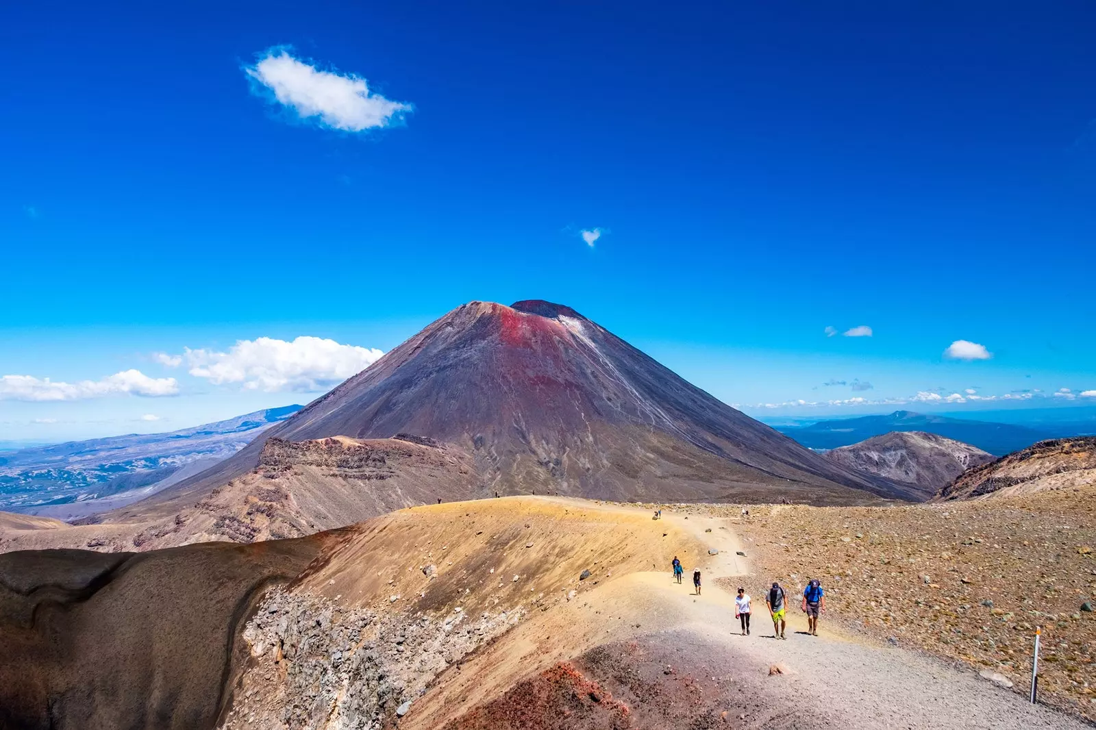
Ngauruhoe Volcano: Mount Destiny, in 'The Lord of the Rings'
However, it is not necessary to be Frodo Baggins nor have the mission to destroy Sauron's One Ring to enter the magnificent trails of the Tongariro National Park.
Every year, more than 70,000 hikers They make the best known route of one of the few places in the world that have been declared a World Heritage Site by UNESCO in two different categories, both for its natural beauty and for its cultural and religious value.
And it was the Maori chief Te Heuheu Tukino IV who donated the most 2,600 hectares that form the national park to the government of New Zealand, with the sole objective that these lands, dotted with rivers, volcanoes and forests sacred to its people, could be admired, loved, cared for and enjoyed by everyone.
The Tongariro Alpine Trek has a length of 12 miles and it is linear, being usual start from Mangatepopo Road to finish at Ketetahi hot springs.
The Tongariro path may seem simple but it is not
When following the path in this direction, one descends from 1,120 masl to 760 masl, making the route somewhat easier. Because, although the characteristics of it do not require technical climbing skills and seems simple for anyone accustomed to walking through nature, The strength and presence of this sacred Maori land should not be underestimated.
Some hikers have lost their lives on a trek in which the weather usually changes suddenly , especially in winter, when the snow can hide the route signs. Therefore, the park authorities always recommend bring food, lots of water – there are no drinking water sources on the trail -, warm clothes, sunscreen and a first aid kit.
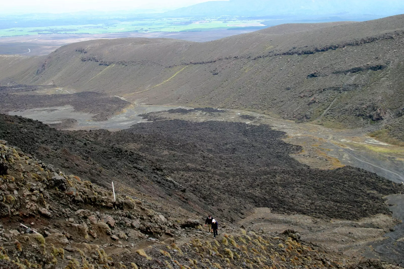
The beginning of this route of some 7 hours long it is quite flat and runs next to the Mangatepopo stream , including a slight ascent to the waters of Soda Springs . Soon after, the path slopes up much steeper, and the vegetation changes remarkably.
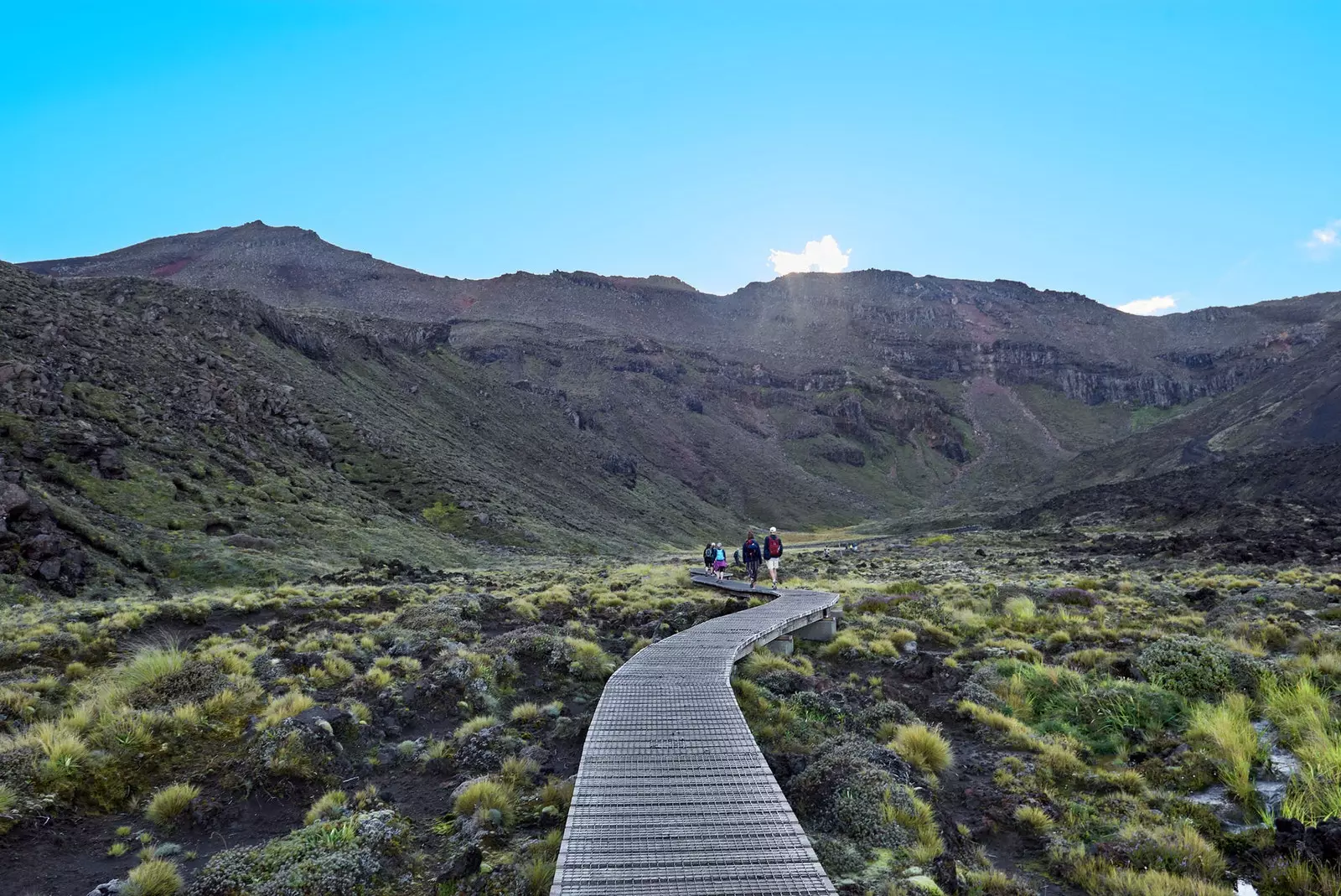
A wooden boardwalk will accompany you much of the way
This part is known as 'Devil's Staircase' and the walker rises from 1,400 to 1,600 meters high in just over half an hour. However, on days of good visibility, the effort has a formidable reward, because when you reach the highest point - very close to the **Cráter Sur (South Crater) ** -, you can enjoy spectacular views of the valley, the distant woods and, to the west, the perfect volcanic cone of Mount Taranaki.
The ground here is unstable, formed by a mixture of lava layers , old and new, that casts doubt on the hardness and consistency of the pavement at each step.
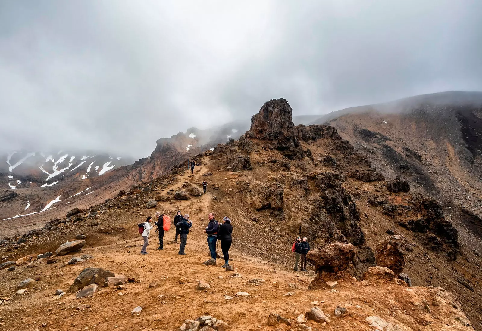
After a false flat, comes the ascent of a cornice, exposed to the wind, which leads to a Martian-like crater: the red crater . The reddish earth contrasts, here, with the grayish tones of the lava and, when looking up from the ground, the irregular profile of the mountains of the Kaimanawa mountain range , accompanied by Oturere valley and Rangipo desert.
Reaching the top of Devil's Stairs
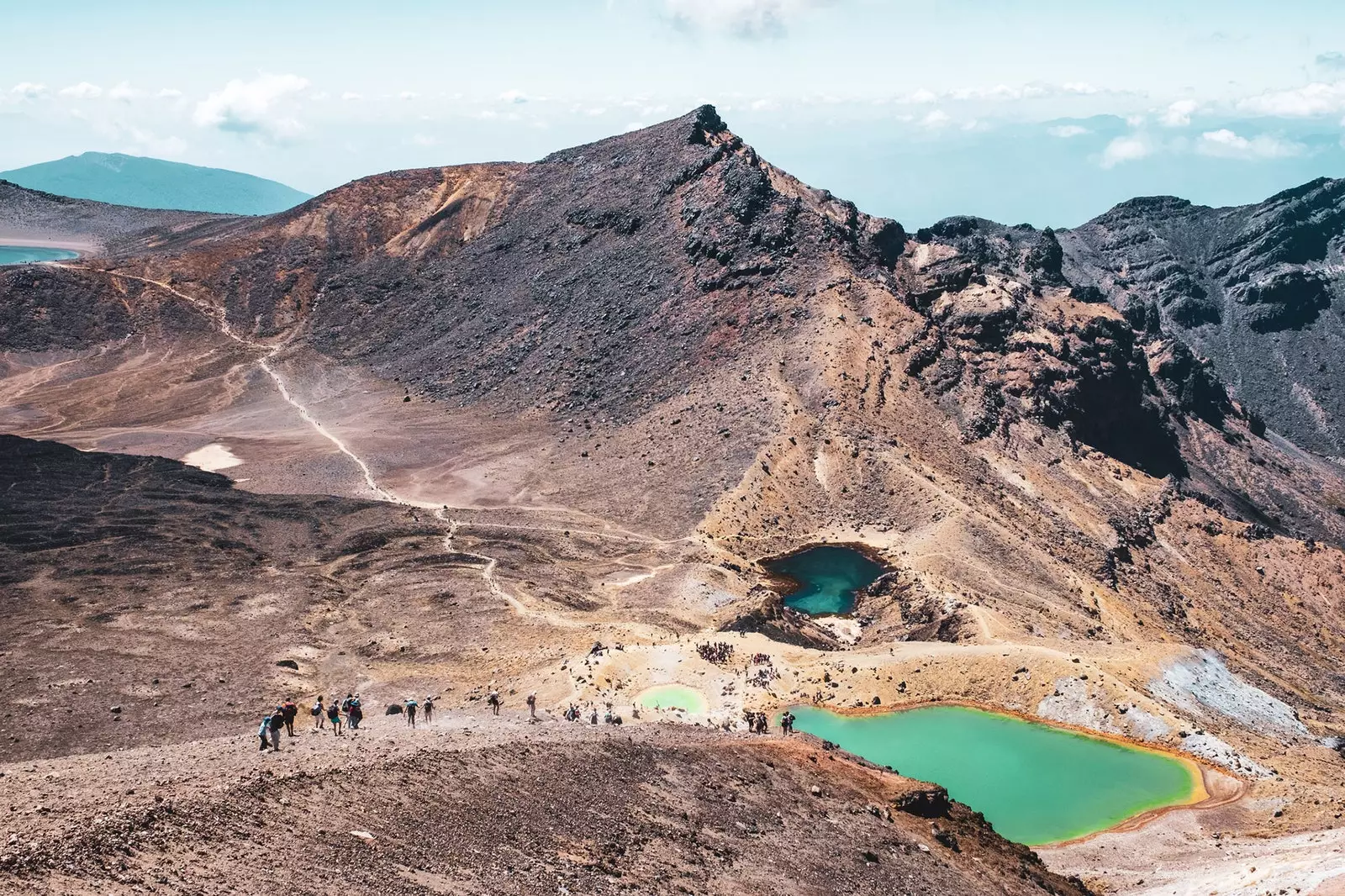
However, nothing compares to the beauty of the Emerald Lakes , towards whom the descending path is impatiently heading.
These lagoons - which emanate a sulfurous smell - take their striking colors from the volcanic minerals that come off the rocks that make up their bottoms and surroundings.
The path continues around the Central Crater and ascends a small slope to the Blue Lake , whose waters have an intense turquoise tone. **This lake is 'Tapu' (sacred)** in Maori culture, and you should avoid touching its waters and eating or drinking on its shores.
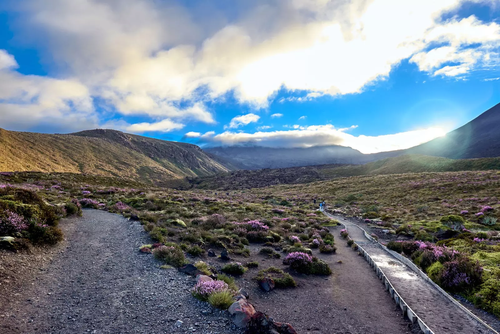
The landscape that you will find on the way is impressive
Leaving behind this turquoise jewel, the path picks up slightly until it reaches the North Crater . This crater is filled with solidified lava and has a diameter of almost a kilometer. From here, you can see Mount Pihanga, the Lake Rotoaira and, somewhat further away, the immense lake Taupo, New Zealand's main natural source of fresh water.
After getting rid of the spell of such views, a zigzagging descent leads to the Ketetehai refuge , in which you can make a brief stop before facing the last two hours of walking.
The final part of the route consists of an almost continuous descent, crossing streams whose courses are framed by large polychrome rocks . Here, lush vegetation returns and a waterfall greets hikers shortly before reach your goal, located in the Ketetahi car park.
It is the end of a journey that leads to the roots of the sacred Maori mountains. Movie sets forged by fire and lava over millions of years, where colors create a supernatural landscape that is worth exploring and enjoying slowly, absorbing every detail and every speck of this ancient force of nature.