
Alberto de Agostini National Park
Some time ago I wrote this: "there are two Patagonias : one –Argentina– is flat, arid, almost infinite. The other –the Chilean– is violent, jagged, brimming with life ". I did it to talk about one of the most spectacular routes on the planet: the Carretera Austral. At that time I wanted to go further in my story, to overcome Cove Tortel , the town of a thousand walkways on the southern limit of the road, and show a territory, if possible, even wilder.
Today, finally, the day has come to tell it. It's about the Chilean fjords at the end of the world , one of the most fascinating places on the planet.
A LABYRINTH IN THE SOUTH OF CHILE
Seen from the sky, it seems as if the earth crumbled . This is the territory of more than a thousand kilometers that extends from Caleta Tortel to Cape Horn , at the southern end of the American continent. This is the system called the marine ecoregion of channels and fjords in southern Chile, an authentic (and fucked up) planetary labyrinth.
We start from Caleta Tortel
That is what the long-suffering navigators of the Magellan/Elcano expedition must have thought – the “fucked up” thing, the first to circumnavigate the planet and, likewise, in crossing that tangle of maritime channels in November 1520. Although they, in reality, only sailed part of it, thanks to the shortcut they found to continue their journey, the Strait of Magellan.
To the south of this strait, the Europeans still had to traverse a labyrinth of mountains, sea and glaciers - today known as Alberto de Agostini National Park – and the other great strait of this region of the world: the Beagle or Onashaga channel , name with which the original inhabitants of the region referred to him. It took more than 300 years for it to be sailed for the first time by a European ship, the Beagle of the Major Robert Fitz-Roy , which crossed it in 1830.
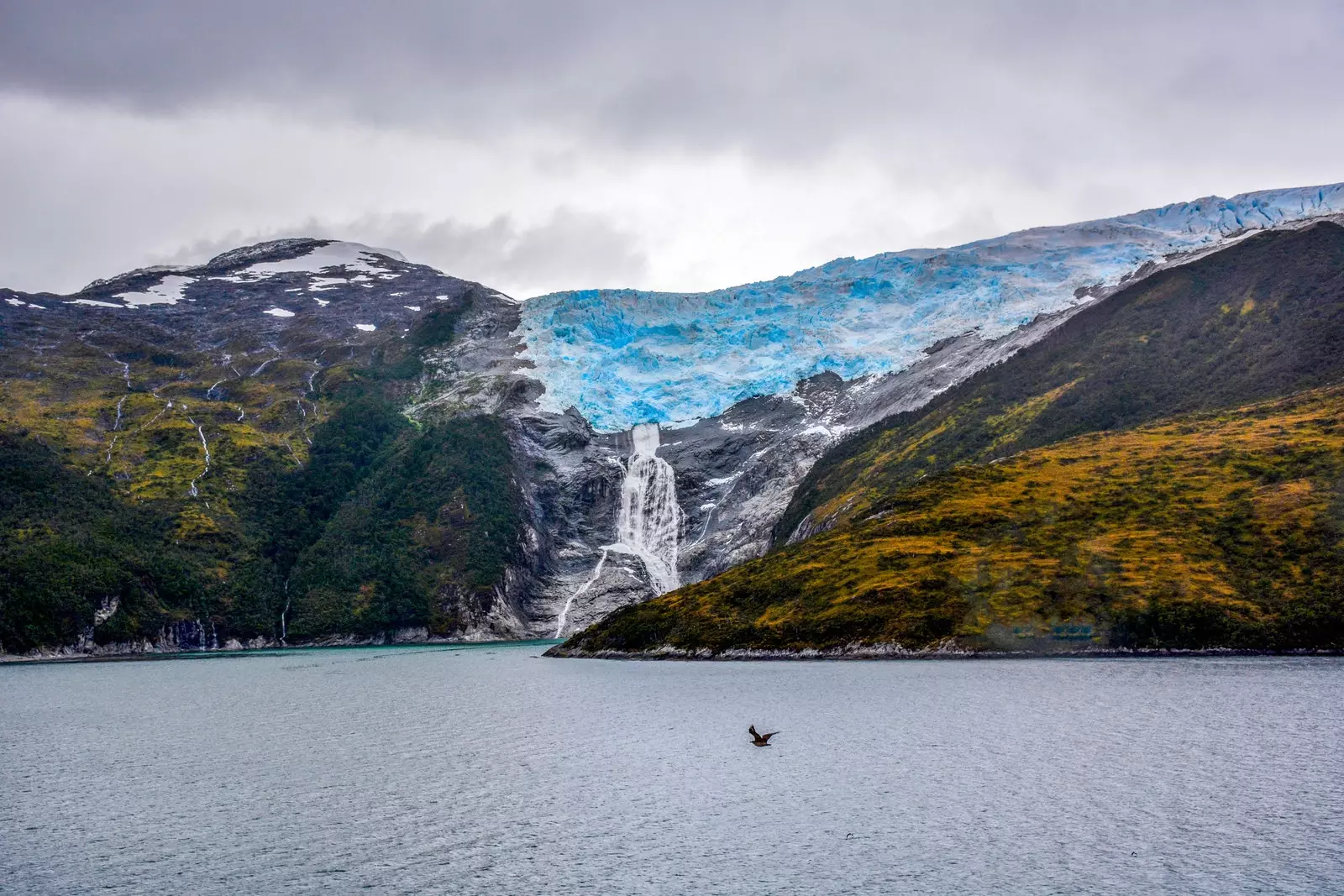
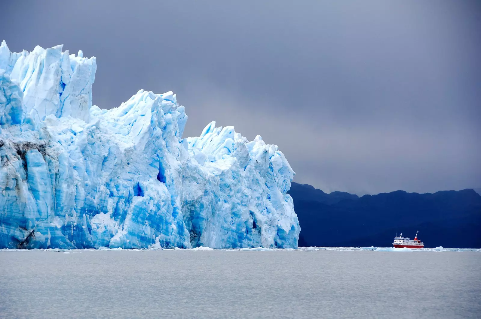
Even so, although this region to the south of the Strait of Magellan –the so-called Fuegian channels– occupies an enormous area, it only covers a third of the whole. Towards the north and up to Caleta Tortel the remaining two thirds expand, a complex system of fjords and canals that branch out like bronchial trees . These territories are those that today occupy the Kawésqar National Park and Bernardo O'Higgins National Park . In the latter is the enormous field of southern patagonic ice , the third largest extension of continental ice in the world, after Antarctica and Greenland. With an area of 16,800 km², the southern field is visible from space as an immense spearhead from which a total of 49 glaciers break off, including the Perito Moreno , one of the smallest of the bunch, compared to the massive Viedma , of 978 km² or Pius XI , the largest in the southern hemisphere outside Antarctica, with 1265 km²–.
But if these data are shocking, it is even more shocking to know that all this inhospitable region has been inhabited for centuries by various native peoples , long before the Europeans arrived with their imposing caravels. Those peoples are the Kawésqar and the Yaganes and their memory merges with the sea, the wind and the land.
Pío XI Glacier, the largest in the southern hemisphere outside Antarctica
THE HUMANS OF THE FIORDS AT THE END OF THE WORLD
When the film director Patrick Guzman entered the canals of southern Chile to film The mother of pearl button , he did it in search of the story of two buttons. One of them was a shirt button embedded in some rails recovered from the ocean and belonged to one of the numerous bodies that were thrown into the sea during the Pinochet dictatorship . The other was much older and Guzmán learned about it through one of the most famous travel diaries in history: Charles Darwin's round-the-world trip aboard Captain Fitz-Roy's Beagle.
As Darwin wrote in his diary, " during the previous voyage of the Beagle, from 1826 to 1830, Captain Fitz-Roy He took a number of Indians hostage to punish them for having stolen a ship. (…) The captain took some of these individuals to England, and also a boy whom he bought for a mother-of-pearl button, for the purpose of giving him some education and teaching him some religious principles".
That boy was known as Jemmy Button and, after his Europeanization process, he accompanied Darwin's expedition to the place from which it came, the Fuegian channels that surround the Beagle Channel beyond ushuaia , on the perimeter of the Navarino and Hoste islands. That is where the yaganes rowed, one of the nomadic canoe peoples that occupied the extreme south of the continent. The other were the kawesqar , located in the northernmost channels, north of the Strait of Magellan. Both peoples built their homes in those extreme regions, occupying the cracks that steep Patagonian islands allowed on their coast and, apart from the geographical space and their lifestyle, they were united by their intimate fusion with the territory they inhabited.
contemplate the end of the world
this is how he explains it Lakutaia le kipa , a Yagán woman interviewed in the 1970s by the Chilean journalist Patricia Stambuk : "we Yagans are named according to the land that receives us, each Yagan bears the name of the place where he was born." Her voice appears in the book Rosa Yagán, lakutaia le kipa: the story of a Yagan Indian from the Cape Horn archipelago , published by Stambuk in 1986. In this book, the writer claims to collect one of the last testimonies of "an almost extinct race, just when six thousand years of its presence in Chilean Patagonia ended."
The term Extinct It is not, perhaps, the most accurate, since even today, descendants of both peoples can be found who maintain their language (in a very small number, yes), their manual arts and their link with the sea. Nevertheless, yes, its ancient nomadic and canoe way of life can be declared extinct , which disappeared (along with a large number of Yagan and Kawésqar settlers, as a result of repression and diseases carried by the colonizers), during the "civilizing" processes of the Europeans, first, and "Chileanizing" processes of the Chilean state, later. .
The footprints of the Yaganes and Kawésqar can be traced along the sea route between Port Williams , the southernmost city in the world, and Caleta Tortel. The journey is long, slow and with numerous dangers. Although also, for this reason, one of the most incredible on the planet.
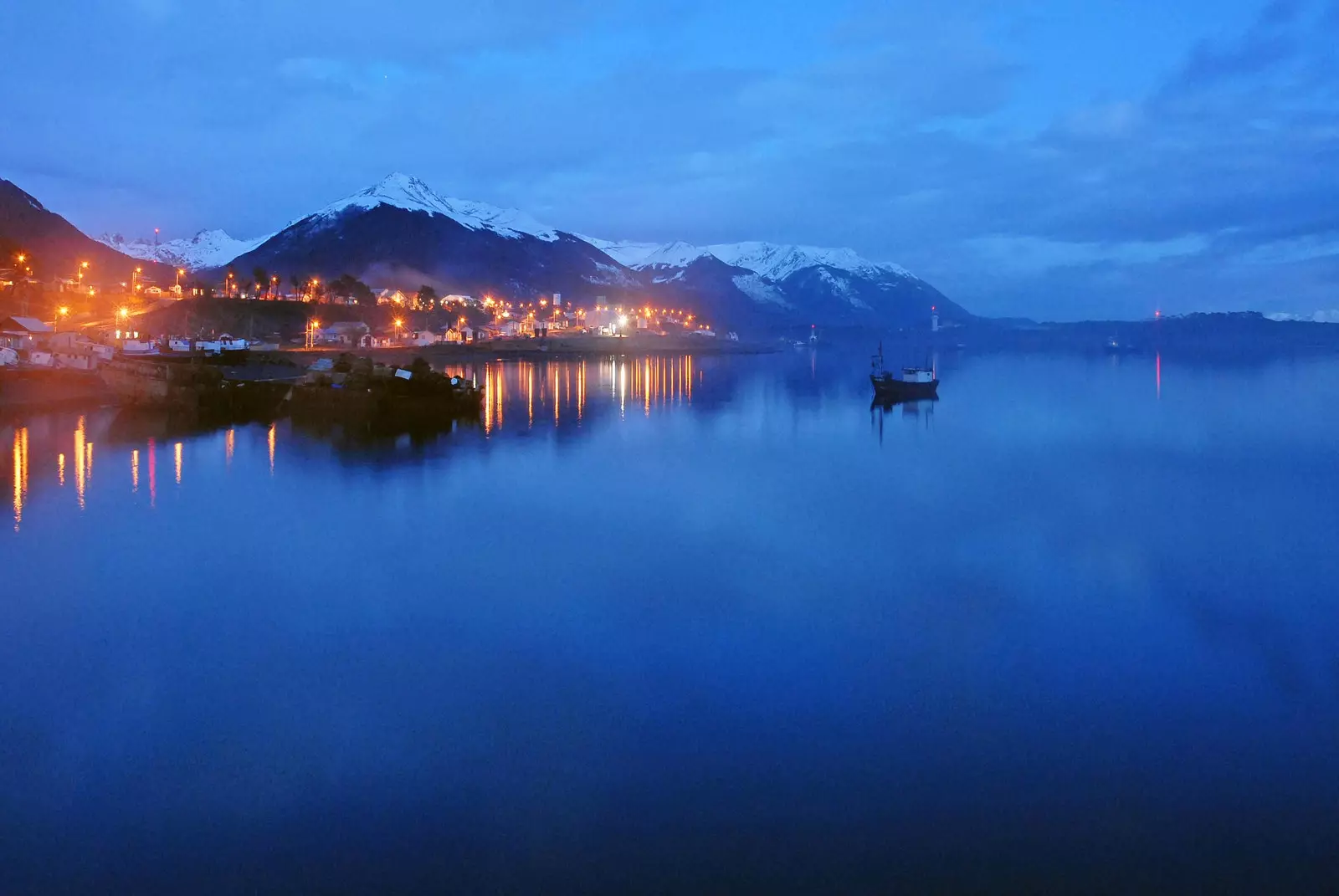
Port Williams
THE CHILEAN ODYSSEY BETWEEN PUERTO WILLIAMS AND CALETA TORTEL
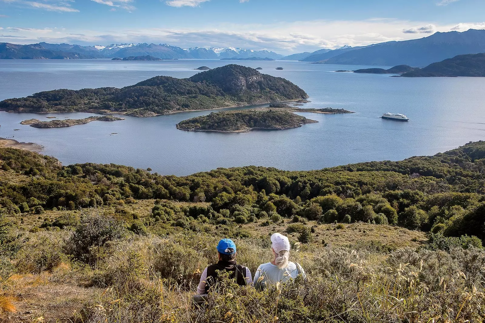
If Homer had been born Yagán (or Kawésqar), the story of Ulysses would have been set in the canals of southern Chile. There is no more ideal place on the planet (not even the Mediterranean) as a lair of Laistrygonians, Cyclopes and other Homeric monsters than the labyrinth of channels and fjords of Chilean Patagonia.
The only form of communication in this region of the world is by sea, on barges where humans, vehicles and merchandise coexist in a kind of contemporary Noah's Ark. The route is made in two navigation sections: first, between the towns of Puerto Williams and Punta Arenas , on a 30-hour tour; after, between Puerto Natales and Caleta Tortel, in a tour that does not usually go below 40 hours of navigation.
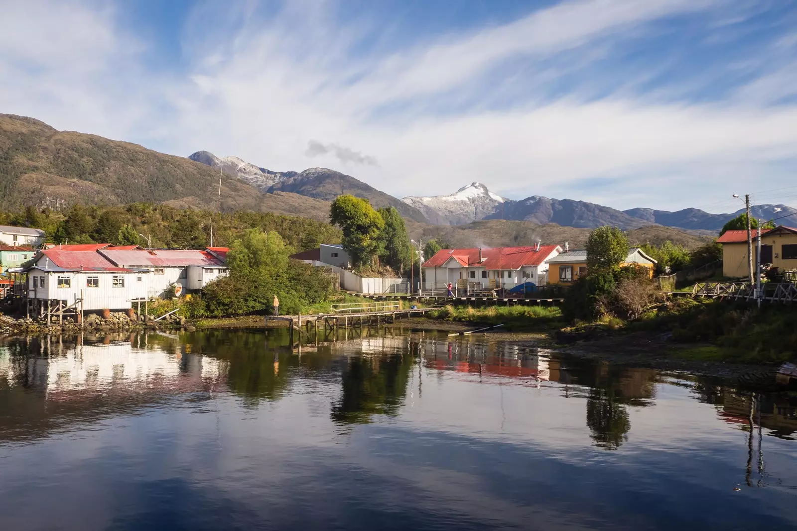
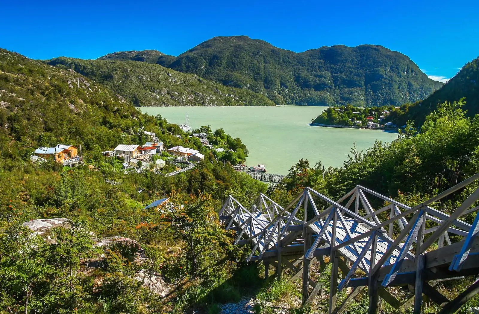
Puerto Eden: the tiny nothing
This tour takes place in an environment practically deserted of human signs: in the more than 1000 kilometers of Chilean territory that extend between Puerto Williams and Caleta Tortel There are only 5 towns, the four already mentioned and the tiny Puerto Edén , a village built on footbridges in a cove of Wellington Island, halfway between Natales and Tortel. That is, in the middle of the most absolute NOTHING.
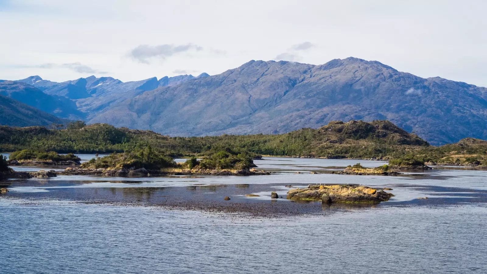
At a rate that varies between 10 and 20 kilometers per hour, the barges enter the jaws of the Chilean fjords extremely slowly, as if measuring each step. For fancy minds (like mine), it is inevitable that symbolic images of heroes who enter, weapon at the ready and with extreme caution, in dark and dangerous territory come to mind. A Fellowship of the Ring in search of the Shadow of Mordor.
As soon as the output ports are abandoned ( Puerto Williams in the first section, Puerto Natales in the second ), one realizes how extreme Chilean Patagonia is, a territory in which the human being is at the limits of survival. Wherever you look, the coast gives no respite: as soon as the sea ends – a cold, aggressive, wind-tossed ocean –, the land rises in vertical walls from which glaciers hang like gigantic frozen bats. There are hardly any loopholes in which to moor, only small beaches, the places where yaganes and kawésqar lit their bonfires.
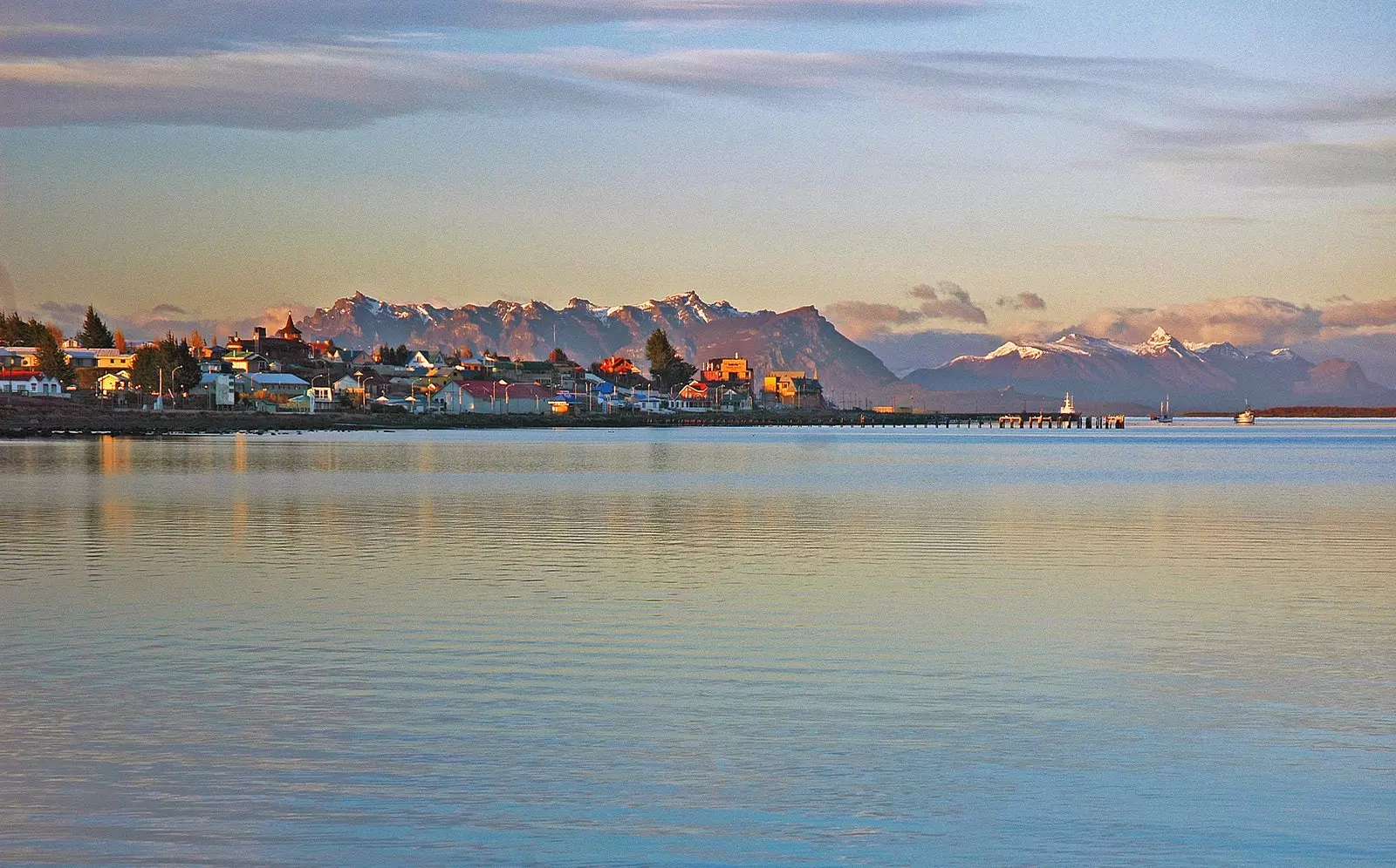
Puerto Natales
If you look up, a cumulus of clouds intermittently covers the sky along the route , dyeing the entire landscape neutral gray and giving it an appearance, if possible, still more hostile . When the sun prevails over the clouds, the combination is tremendous: flaming orange sunrises that fight against sapphire, arctic and cobalt blues , followed by peaceful middays where sporadic sources of light bring out the true colors of the landscape, as if they were the protagonists of a theatrical show.
The long hours of travel allow the mind to travel . While observing the succession of mountains that emerge from the water, one imagines oneself in the skin of an ancient sailor aboard the Trinidad de Magallanes or Fitzroy's Beagle . Or in that of a Yagán or Kawésqar canoeist paddling, exhausted, in search of a refuge among the rocks. Would they feel the same astonishment, the same fear, seeing themselves so tiny and vulnerable in the middle of that labyrinth of canals? Would they record those images inside your mind, as I did and now recall in these lines? The territory is so virgin, so absent of anthropic signs , which gives the impression that every time a human passes through its corridors of water and rock, he feels like a pioneer in completing such a feat.
The route, from time to time, leaves behind small geographical landmarks, such as navigation next to the Cape Froward , the southernmost point of the American landmass; the icebergs that have broken off from the glaciers of the Wide channel, on the way to Tortel; or the arrival at one of the great milestones of the trip at this stage of the route: the village of Puerto Edén, one of the most isolated and unknown places on the planet.
Puerto Eden is located in the very center of the patagonic labyrinth (in fact, it is the closest town to the aforementioned Pío XI, the massive glacier of the southern ice field) and its toponym puts on a platter the inevitable literary comparison: reaching it after almost 26 hours of navigation is like approaching a kind of paradise . And not only because of the possibility of walking on dry land again (although this is saying something, since 90% of the population is built on footbridges that fly over peat) but because of the beauty of its location and its landscape.
The surroundings of Puerto Eden
Puerto Edén has its origin in 1937 , after the construction of a support station for a seaplane line that was intended to link the cities of Puerto Montt and Punta Arenas . Around this station, the dispersed Kawésqar population gathered spontaneously until, in February 1969, it was integrated into the Chilean population system. In Puerto Eden are some of the older Kawésqar descendants (some of whom are interviewed by Patricio Guzmán in The Mother of Pearl Button ) and, although the population is already very mixed, you can still see remains of its ancestral traditions, such as the elaboration of basketry from the ñapo (a kind of reed), shellfishing of crabs or the collection of murtillas (small red fruits ).
As the barge only passes through Puerto Edén once a week, the options for discovering the place are very limited: either the short time it takes to unload the goods, or the seven days it takes for the next boat to pass through. Brush the honey with your lips or eat the jar by the spoonful? It all depends on the time available and the endurance to feel totally isolated in the middle of the labyrinth . It was clear to me: I opted for the second and thus I could experience in first person the expeditions in search of murtilla, improvised basketry classes and sopaipillas (fried wheat flour masses) or the power outages that occur, props, between 12 at night and 9 in the morning and between 3 and 5 in the afternoon.
After Puerto Edén and the feeling of being on dry land, there are thirteen hours of navigation left, thirteen hours in which the landscape once again reminds us how fragile human beings are in these latitudes. It does, for example, with scenes like the rusty skeleton of the cargo ship Capitan Leonidas -could only be called after a Greek hero-, stranded since the seventies in a shallow area of the Messier Channel, or the cadaveric remains of whales. These beings – sea monsters if it were the Kawésqar Homer who spoke –, are the protagonists of this last part of the route to Tortel, when the Messier channel widens to open up to the Pacific. If you're lucky, you might be able to see the nasal jets coming from their breaths.
The last section runs towards the interior of the continent, on the way to Caleta Tortel and the mouth of the Baker River, the mightiest in Chile. The Baker, of an intense blue color throughout its journey, is responsible for the turquoise tone that surrounds Tortel, which, seen from the deck, evokes the same sensation that was felt when arriving at Puerto Edén: a town that seems to float, ethereal, on countless walkways.
Only this time, you don't feel so isolated and vulnerable, because now you have a land route that allows you to continue your journey on land, a land route that could serve as an inspiration to the Fuegian Homer to continue the story of his Odyssey.
But that, as I said at the beginning, is another story.