
Pumalin Park Douglas Tompinks
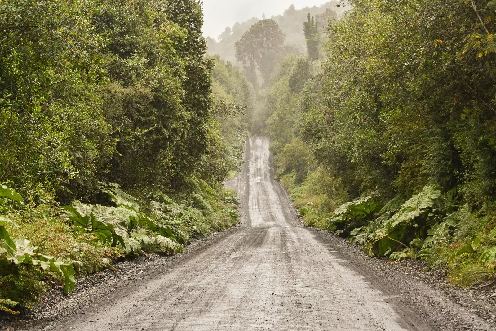
It is abrupt, vertiginous, almost aggressive; paved at times, gravel, dirt and mud for the most part. Like a nocturnal animal glides between fjords and glaciers, volcanoes and mountain ranges , ocean complex lakes and rivers so blue they would rival any beach in the Philippines.
Built by a dictator with the name of a story –or a clown–, his has the common trait that only epic places reach, those that get stuck with a thumbtack somewhere between the cerebellum and the pupils. And yet, very few know about it.
Is named Austral road , measures 1,240 kilometers and is one of the reasons why Chile could be the most beautiful country on the planet.
THE CARRETERA AUSTRAL, A PLANETARY SHOWCASE
There are two Patagonias: one – Argentina – is flat, arid, almost infinite. The other – the Chilean one – is violent, jagged, brimming with life.
The Andes are the cause of this difference: to one side, the immense pampa; on the other, the irregular surface of a piece of the earth's crust that wrinkles like an accordion due to volcanic eruptions and earthquakes.
And in the midst of all that earthly chaos, the Southern Highway.
The Carretera Austral: the trip of a lifetime
Chile, year 1973. A coup annihilates the government of Salvador Allende and gives way to almost two decades of military dictatorship. In front, Augusto Pinochet , the –for better or for worse– main architect of the development of the Carretera Austral and of the fact that the south of Chile begins to be connected by land.
Until then, the city of Montt port It was the last point in continental Chile that the routes reached. From there it was only possible to continue by boat or take a monumental detour through the neighboring country and its infinite pampas.
The Carretera Austral is one of the strangest roads on the planet. The blame for everything lies with the Chilean orography –a headache for any engineer– with its nooks and crannies, its fjords, its glaciers and its volcanoes.
Almost since its inception, 50 kilometers from Puerto Montt, the Austral has to give up its route: one of the many fjords and inlets of the sea that pierce the coast makes it necessary to change to a means of transport that has already become a hallmark of southern Chile, the ferry boat.
Up to four cuts occur during the route, forcing trucks, buses, cars and pedestrians to advance to the slow rhythm of the tides.
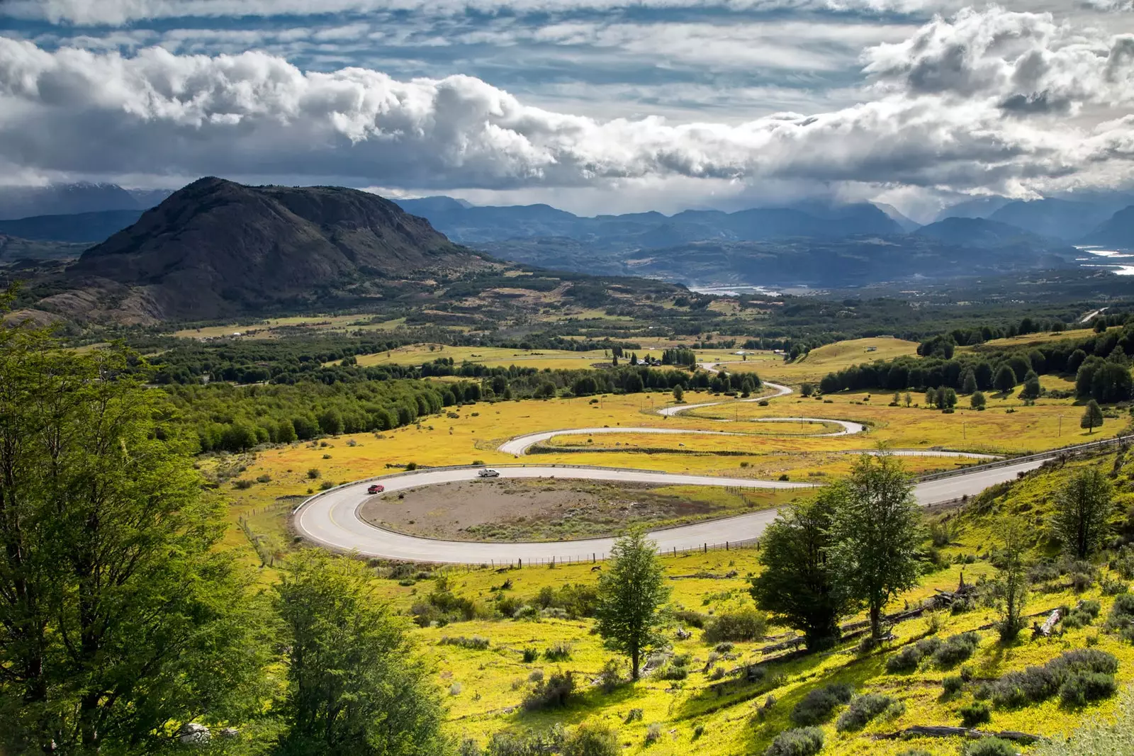
Traveling along the Carretera Austral is like walking through a planetary showcase: almost all the geographical features of the Earth follow one another along its path.
Almost all the geographical features of the Earth follow one another along its path
First come the ancient larch forests –species that can reach up to 3,600 years– from national parks Andean Alerce and Hornopirén. Bounded between fjords, these forests are the first attractions that the southern traveler will find during the tour.
But attention will soon drift elsewhere: the Michinmahuida, Chaitén, Corcovado and Melimoyu volcanoes greet the traveler reminding him that he is in the wilderness and that there the one who rules is the planet Earth (as happened in the eruption of Chaitén in 2008, which turned the town of the same name into a ghost town).
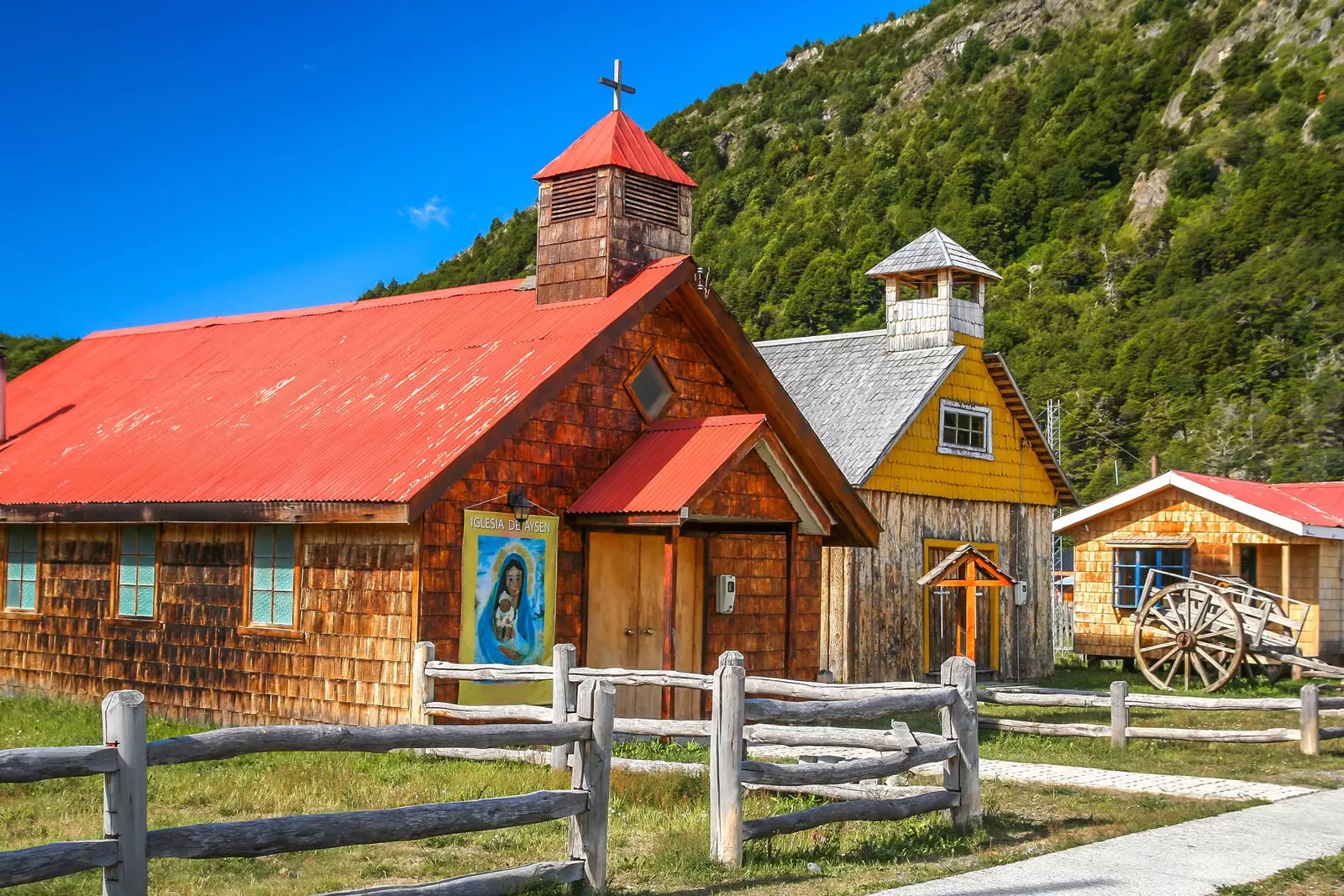
Very close to Chaitén is another national park, one with a personal history of philanthropy, distrust and skepticism: Pumalin Douglas Tompinks Park. With the life of Douglas Tompkins a movie could be filmed.
Founder of the North Face and Esprit brands, he focused his activity on adventure sports and it was in Chile that he found his Garden of Eden. This led to leave the business world and turn to conservation and ecology.
Under the motto that he could living off the forests without cutting them down, His first step was to buy 17,000 hectares –in what is now the Pumalín park– to protect the native forest from uncontrolled logging.
This was followed by more land purchases in other parts of southern Chile. These movements generated skepticism and political opposition, provoking a certain social mistrust. Years had to pass before they began to believe in their good intentions.
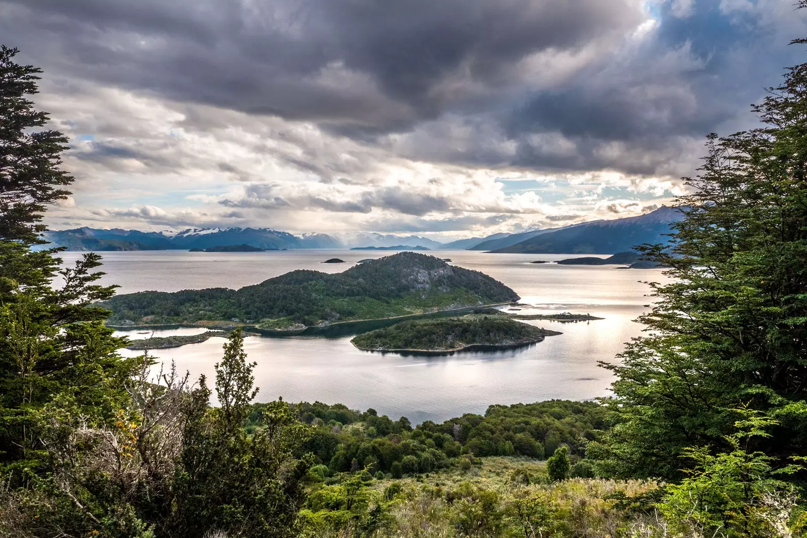
In December 2015, having abandoned his life as an environmentalist and in the process of ceding a large part of the Pumalín to the Chilean state, Tompkins died after suffering hypothermia when his kayak capsized in the Lake General Carrera (the lake with an ocean complex), one of the great points of interest on the route of the Carretera Austral.
He was 72 years old when he said goodbye to him doing one of the activities that had taken him to that remote place on Earth.
General Carrera, the lake with ocean complex
GLACIERS LIKE MUSHROOMS
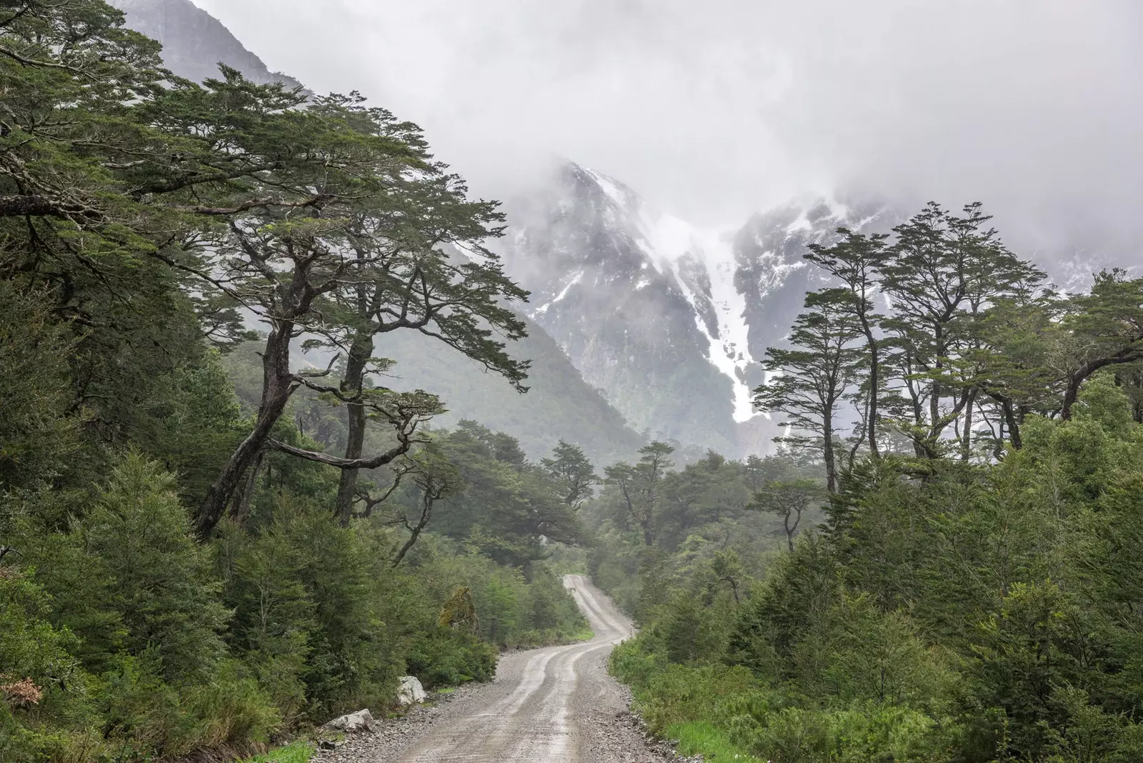
It is strange for someone who is not used to seeing them. When Lake Yelcho is crossed, shortly after the rebuilt city of Chaitén, they begin to appear on both sides of the road, perched on the mountains.
They are glaciers, whose tongues –in some cases very consumed by the increase in terrestrial temperature–, herald the arrival in colder regions.
The next point of interest on the route is precisely a glacier. Its about Hanging Snowdrift or Queulat, a glacier with the spirit of a climber.
Located near the village of Puyuhuapi –founded by Central European settlers, whose imprint can be seen in the local architecture–, the Queulat is one of the most spectacular glaciers in the world due to its location: Perched on a ledge, part of its tongue “hangs” from the mountain, spitting out the melted ice in two impressive waterfalls.
After the glaciers, there is a bit of calm on the route. Coinciding with the final asphalt sections of the Carretera Austral, the road reaches Coyhaique, the last big city on the road.
From here, in a few kilometers the gravel will begin –which will continue until the end of the route, in Villa O'Higgins– and a rosary of towns and villages scattered between lakes and mountains.
mountains like Castle Hill , a prominent peak that guards a sparkling lagoon near its summit, and lakes like the incredible General Carrera, the lake that thinks it's an ocean.
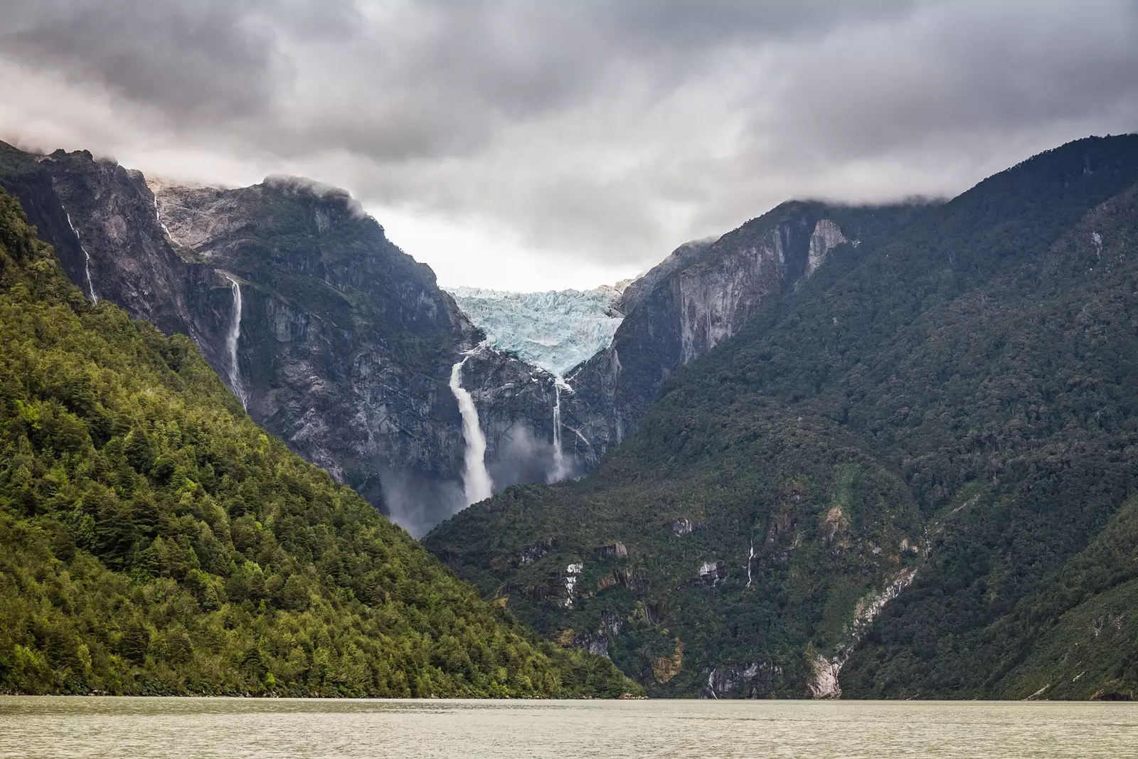
The Hanging Glacier or Queulat, a glacier with the spirit of a climber
THE LAKE-OCEAN THAT CROSSES BORDERS AND THE NORTH PATAGONIAN ICE FIELD
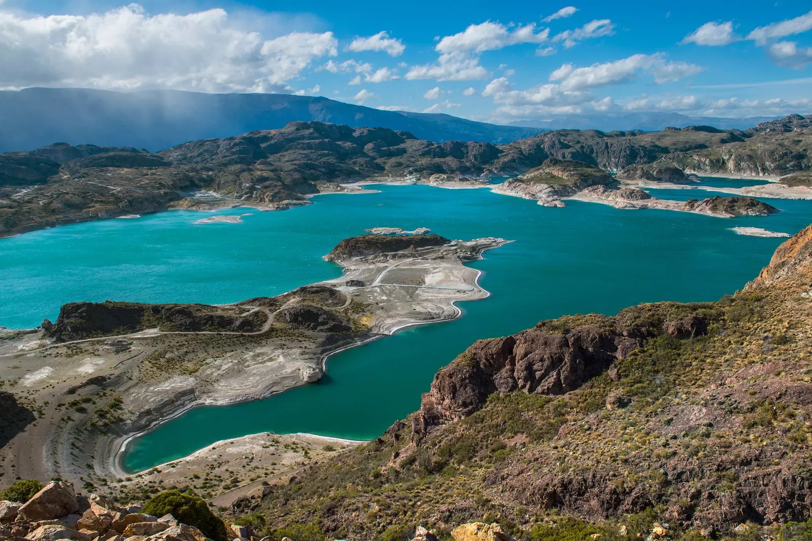
Chile and Argentina do not even agree to name the lakes. That is what happens with the General Carrera/Buenos Aires, two names that, in reality, do not explain anything, since they only mention the part that corresponds to each country of what is the second largest lake in South America.
The Tehuelche people – originally from the area – did know how to call things by their name before both countries existed. Chelenko (turbulent waters) was the name used to recognize that mass of water of 978 square kilometers that produces waves of up to three meters due to the blow of the Patagonian winds: an ocean in the middle of the Andes.
Those turbulent waters of the Chelenko – the same ones where Douglas Tompkins lost his life – are the great jewel that attracts hundreds of travelers to this area thanks to its turquoise blue color, which would make the best beaches in the Pacific pale.
But its waters also contain several stone treasures. Puerto Río Tranquilo, on the banks of the Chelenko, It is one of the most important tourist spots on the Carretera Austral.
It is for two reasons. The first, as it is the point of departure for the –very– numerous boat expeditions that take tourists to the marble chapels, a set of caves excavated in the marble surface of the walls of the Chelenko.
The second reason is that Río Tranquilo is the closest populated place to one of the wildest territories in Chilean Patagonia: the northern Patagonian ice field.
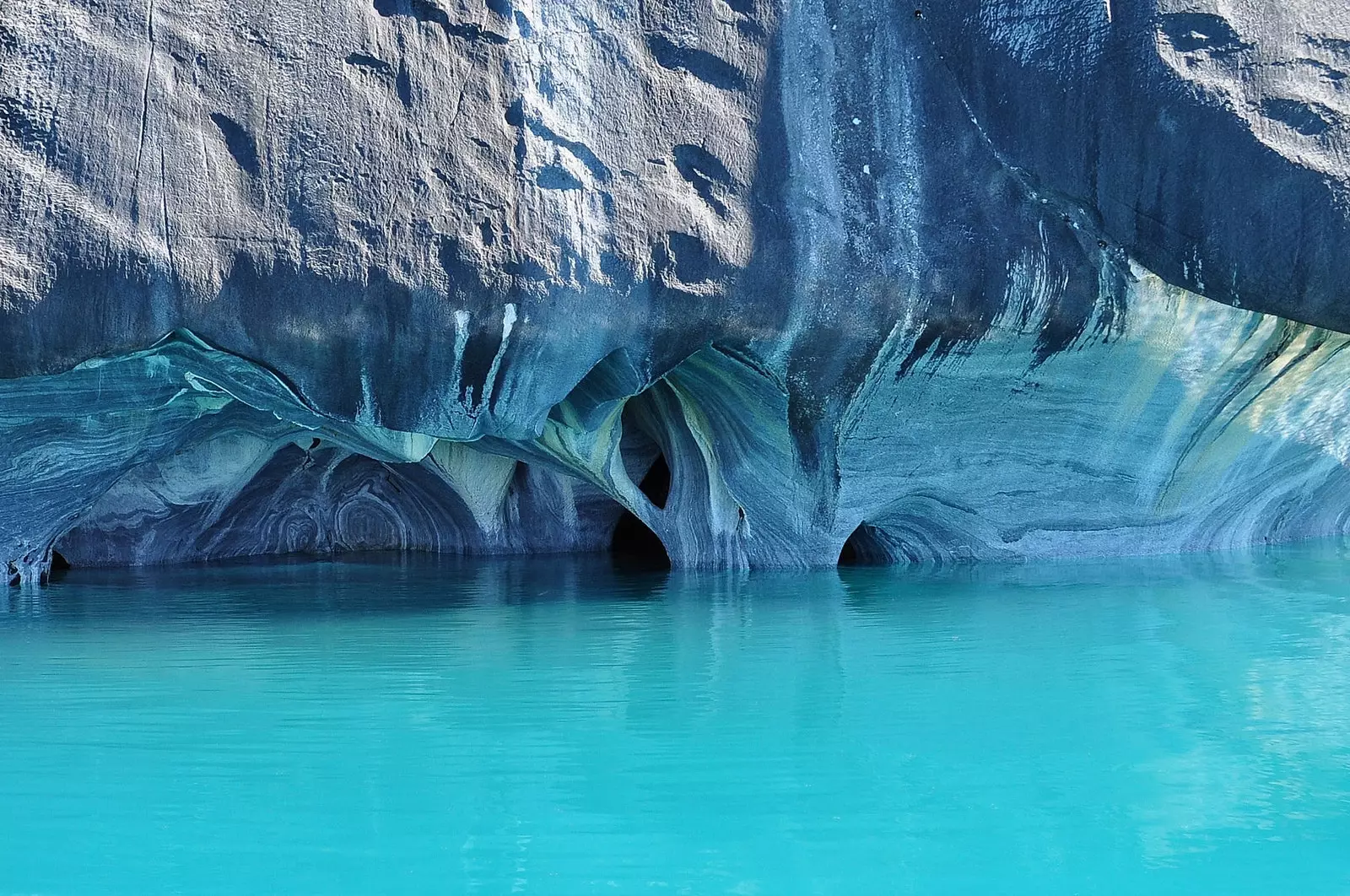
The spectacular marble chapels
It is known as the Northern Patagonian Ice Field a vast expanse of glacial ice located in the Chilean region of Aysén.
A cluster of ancient ice of 4,200 km². Much smaller than the gigantic southern field (16,800 km²), the northern Patagonian ice field is known, above all, for the presence of the San Rafael glacier, the closest sea-level glacier to the equator in the world.
It is at this point, starting from Puerto Río Tranquilo, that the Carretera Austral enters a new phase of its route: that of slip in the best possible way between the mountain giants of the ice field -to West- and the Andean mountain range -To the East-.
Not an easy task that, as compensation, rewards the southern traveler with the best landscapes of the entire route.
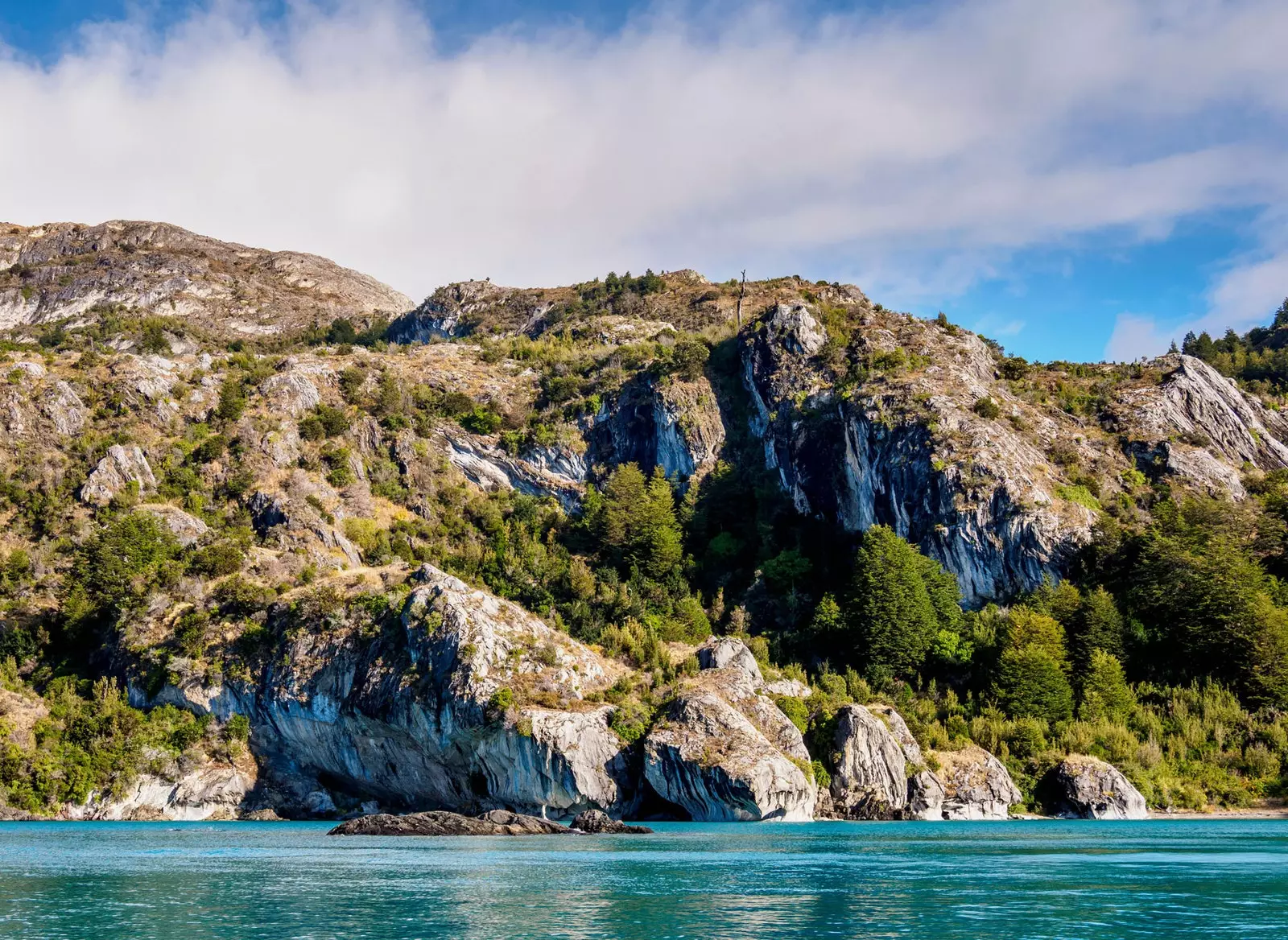
Puerto Río Tranquilo, in the Aysen region
FOLLOWING THE BAKER TO CALETA TORTEL
For those who are used to seeing rivers, they will seldom find one the color of the Baker. Born from the turquoise waters of General Carrera (sorry, Chelenko), the baker river –pronounced 'baquer', as it sounds– accompanies the Carretera Austral during the first kilometers after its birth.
This is a real danger for everyone behind the wheel: the gaze is inevitably directed towards that impossible blue strip that runs parallel to the road.
But beauty has an expiration date: a few kilometers away, the Baker receives the grayish Nef as a tributary, making it more mighty but paying an expensive tribute in return: losing part of its virginal blue.
Reduced the attraction of the beginning, the southern traveler turns his attention back to the mountains that rise on both sides of the road, while the Baker separates from the layout of the route.
What seemed like an inevitable divorce turns into an unexpected reconciliation a few kilometers from the fork that leads to the southern jewel of the Austral route: Caleta Tortel, the town of the footbridges
It is hard to believe that after seeing ancient forests, pointed volcanoes, hanging glaciers and turquoise lakes and rivers, a village built by humans can surprise the traveler's already over-stimulated attention. That is what happens with Caleta Tortel.
Located in the Baker delta and surrounded by islands and fjords, Caleta Tortel survives based on wooden walkways in an environment where it would be more worthwhile to have been born with wings or gills.
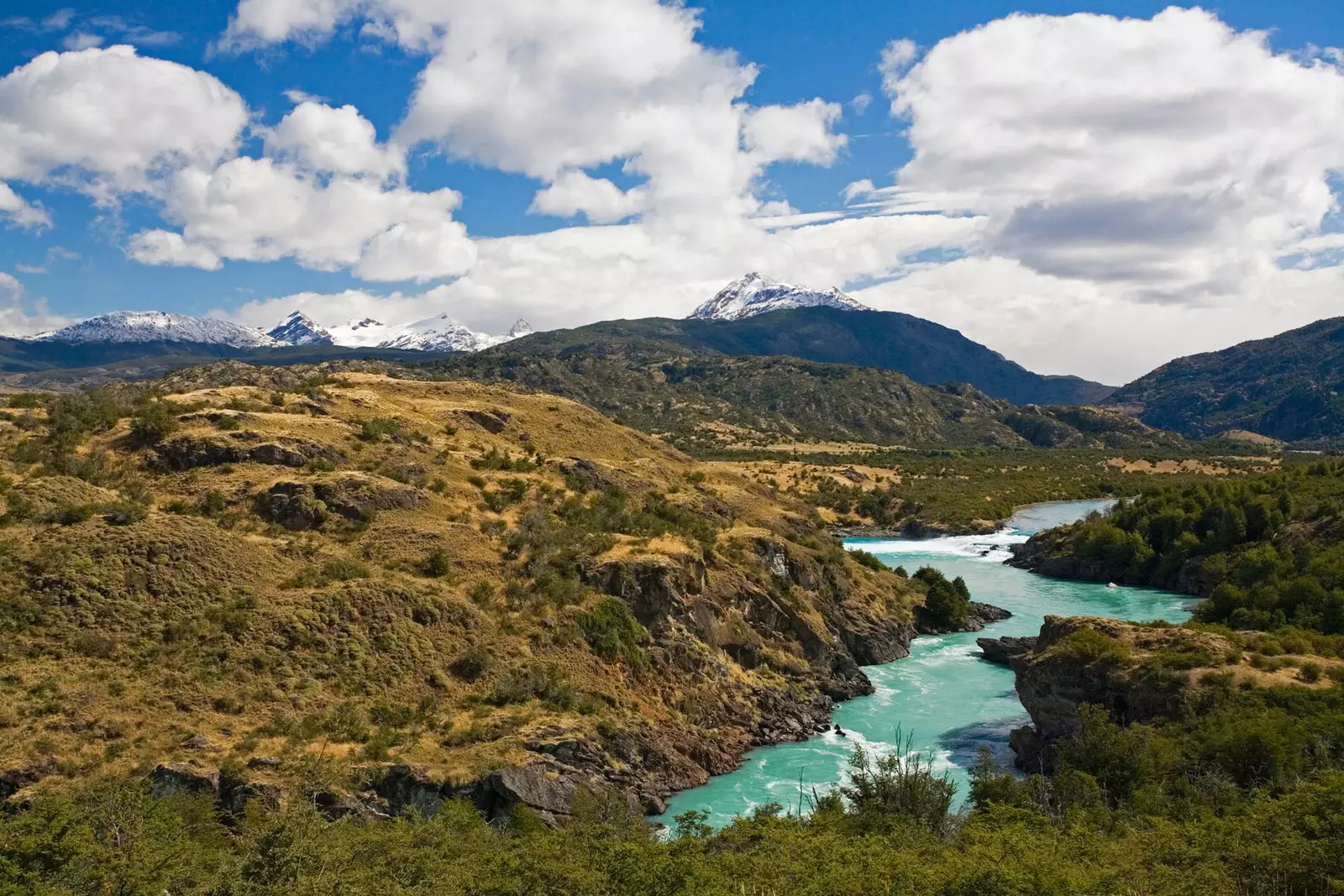
The Baker River and its wonderful turquoise color
Founded in 1955, Caleta Tortel did not know what a car was until 2003, moment in which the connection with the Carretera Austral was built.
Until then, all movements were made by air and, above all, by sea, connecting with the towns of Puerto Montt (two days sailing north) and Puerto Natales (almost three days sailing to the south) .
This maritime connection with Puerto Natales turns Caleta Tortel into one of the three key connection points of the southern limit of the Carretera Austral. the other two are Puerto Yungay, which was for decades the end of the Carretera Austral, and Villa O'Higgins, the long-awaited final point of every southern traveler.
VILLA O'HIGGINGS, OR HOW TO STOP THE ENEMY
Villa O'Higgins was born in 1966 as a buffer town. In the eternal –and sickening– Patagonian border fight between Chile and Argentina –which a year before had caused the death of a carabinero in the so-called “Desert Lake conflict”–, the Chilean state decided to found a city where there were only a couple of houses.
Like someone who performs a chess move, the inhabitants of the area, who for decades had been inhabiting a nameless place, became the founders of Villa O'Higgins, the city that would serve as a buffer against the uncomfortable neighbor.
Villa O'Higgins, the long-awaited final point of every southern traveler
Located in the middle of nowhere to the north of another lake with a two-headed name (O'Higgins/San Martín), Villa O'Higgins came out of its land isolation in 1999, when the 111-kilometer stretch that linked it with Puerto Yungay was completed.
Turned into the final milestone of one of the most spectacular roads on Earth, Villa O'Higgins is the dream place for any human with a desire for adventure: surrounded by lakes and mountains and on the northern limits of the southern Patagonian ice field, the third largest extension of continental ice in the world–after Antarctica and Greenland–.
From this gigantic area of 350 kilometers in length, a total of 49 glaciers, distributed between Chile and Argentina –among which is the famous Perito Moreno, one of the smallest in the group, compared to the massive Viedma (978 km²) or Pío XI (with 1265 km², the largest in the southern hemisphere outside Antarctica) –.
From Puerto Montt to Villa O´Higgins. 1,240 kilometers of travel through one of the wildest places on the planet, making slalom between volcanoes and glaciers by a route that dreams of continuing to grow until it connects with the true southern limit of the country –and the continent–: Puerto Williams, on Navarino Island, the new city at the end of the world.
Isla Navarino, the new city at the end of the world