
Southeast Regional Park, where the Manzanares and Jarama rivers intersect
The Southeast Regional Park has a total of 31,550 hectares that extend throughout sixteen municipalities of this zone of Madrid (Aranjuez, Arganda, Chinchón, Ciempozuelos, Coslada, Getafe, Madrid, Mejorada del Campo, Pinto, Rivas Vaciamadrid, San Fernando de Henares, San Martín de la Vega, Titulcia, Torrejón de Ardoz, Valdemoro and Velilla de San Antonio).
There are therefore many ways to visit it, with a great variety of itineraries and trails . We propose one that runs along the banks of the Manzanares River to the Presa del Rey , which retains its water shortly after being discharged into the Jarama River . Ideal to do on foot ( about three hours round trip ) or, as in our case, by bike (variable depending on the starting point).
The entrance access to the park of our proposal would be the Manzanares Bridge (coordinates 40.32461, -3.55158) , where we will park to start the walk in case of going by car. It is located next to the so-called Salmedina road , path to the left of the Manzanares river in the vicinity of Rivas-Vaciamadrid which also runs through two of the most famous pilgrimage routes in our country: the Santiago's road and the Path of Ucles . We have reached it by pedaling from the Cerro de los Ángeles (Getafe) through the Vereda de la Torrecilla. By car, the easiest thing would be to leave the A-3 at the height of Rivas-Vaciamadrid (exit 19 towards Valencia) and take the Camino de Uclés at the position of the Migueles, the trenches that were dug in the Cerro de la Oliva during the Civil War and where the Jarama 80 association organizes guided tours. In any case, it will be enough to write our destination in our trusted GPS and its instructions will do the rest.
In the vicinity of the bridge we will have already seen the large number of white storks that inhabit this land . Also its flora, among whose trees we will see oaks, gall oaks, poplars, ash trees and various pine forests . Shortly after crossing it, after crossing a drawbridge and leaving a mansion on the right, we will take the path that goes to the left, which will take us without any loss to our destination: the King's Dam.
The tour will not be wasted. On the left we will have the Manzanares River (visible only in some plots), on whose banks we will see various crops and endless expanses of cornfields . We will see that there are various ramifications and bridges that cross it, but most of them are accesses to private hunting reserves (they are signposted). From the Ecologists Association of Jarama "El Soto" They recommend "not traveling off the beaten track", since "we must prevent the abuse of hunting from ending in tragedy".
On the right, the cliffs of the Hills of the Marañosa , one of the most characteristic enclaves of the park. Geological formations whose cuts would make us believe that we are in the Arizona desert if it weren't for the greenery that flourishes on its slopes. Ideal setting for any Wild West movie. They even have their own legend, as a result of a fire that occurred at the end of the Civil War (1939) of which only an olive tree survived . The tree acquired magical connotations and superstition would end up removing it from there, according to some even the Faculty of Fine Arts of the Complutense University of Madrid. Another more recent fire, in 2004, destroyed part of its forests, which were supposedly pending reforestation.
The truth is that this area was the scene of many battles during the Civil War, so it is full of trenches, bunkers and machine gun nests . Also of caves excavated by man, many at the foot of our path.
We will also see various rockfalls . There will come a time when we have to overcome a fairly steep slope that will force us to get off the bike: we are reaching the end, and the most spectacular place without a doubt. If we go up to the stone balcony on the left, we will have a great panoramic view of the surroundings: on the left, the place where the Manzanares joins the Jarama ; front, the Lagoons of the Vega del Porcal , part of the 123 lagoons that extend through the park between lagoons and wetlands; on the right, the King's Dam , just after seeing an abandoned lookout post.** The pass that crosses it is closed to the public, so for us it is time to turn around, although the path continues**.
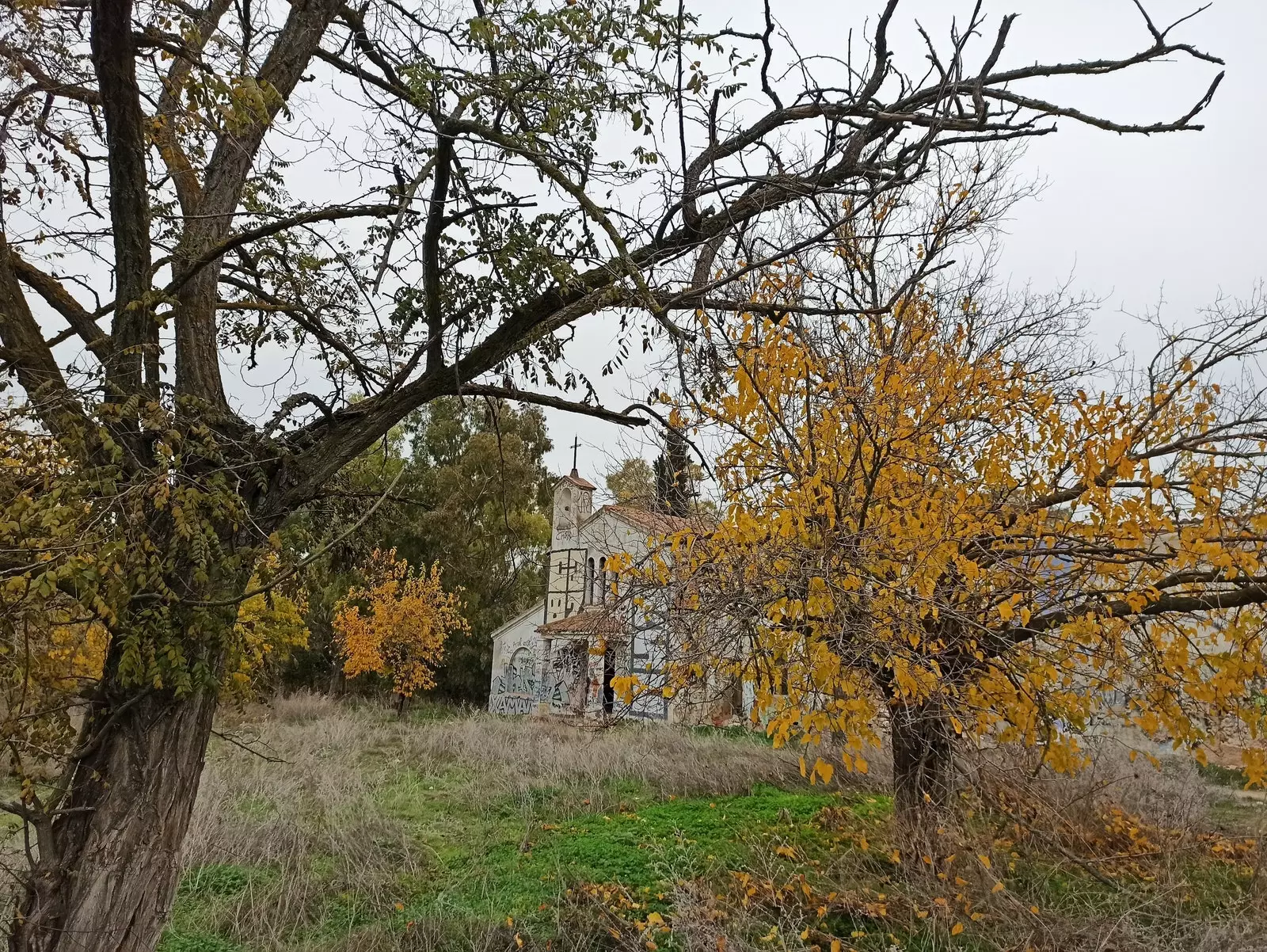
We will make the return by undoing the path to the Manzanares Bridge . Once there, instead of crossing it, we will continue straight on the Path from the Aldehuela to Vaciamadrid . As its name indicates, it will take us in a while to the Aldehuela Trappist Convent , the abandoned monastery of Perales del Río protagonist of all kinds of bizarre stories. From being occupied by Republican troops during the Battle of Jarama to tragically making headlines in 2011, when the bodies of two attendees of the multiple raves that were organized inside were found dead (commonly known as the “ case of jimsonweed ”). It is currently in an advanced state of deterioration and, in addition to being illegal, it is dangerous to look inside. Final touch to an excursion that has everything: peculiar enclaves, fauna, flora, geology and many remains of our recent history.
SUBSCRIBE HERE to our newsletter and receive all the news from Condé Nast Traveler #YoSoyTraveler