
imagine being there
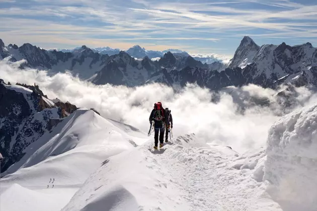
Its 4,810 meters make the Mont Blanc at the highest point in the European Union. Climbing it is the dream and at the same time the terrifying challenge of many climbers. Google has taken its 360º cameras to the top with which anyone can see what the ascent to this peak is like, enjoy its views and be aware of the extreme conditions of this adventure, reports 20minutes.
The interactive maps obtained after the expedition are divided into four stages. In them, you can live the mountain exploration together with great experts; know how athletes train to reach the top; enter the glaciers to raise awareness about the problem of climate change and, finally, the long-awaited ascent to Mont Blanc following the route of Goûter. IM-PRE-SIO-NAN-TES the views.
*** You may also be interested in...**
- The best routes around Benasque
- Downhill Sledding Fever
- The snow is coming: news of the 2015-2016 season
- The 13 best ski resorts in the world
- Destinations to make the perfect snowman
- Everything you need to know about snowboarding, newbie
- Hot Snow: snowy places for faithful and promiscuous of the snow
- 'Mythical Descents': snow, sun and adrenaline - These Instagram accounts will make you leave everything for the mountains - Mountain walkers: we have to go to Benasque
- Long live the mountain! Ten natural treasures of Catalonia
- All current articles