
Paiva footbridges: walking over the abyss
The Paiva River, north of Portugal , has gained fame thanks to its megastructures. The most recent to join the list has been the 516 Arouca, the longest pedestrian suspension bridge in the world, with 516 meters . However, this region already became popular in 2015 with the opening of an attraction, if possible, even more spectacular: the Passadiços del Paiva , A network of more than 8 kilometers of footbridges that enter the gorge in a vertiginous journey together with waterfalls, archaeological sites and river beaches.
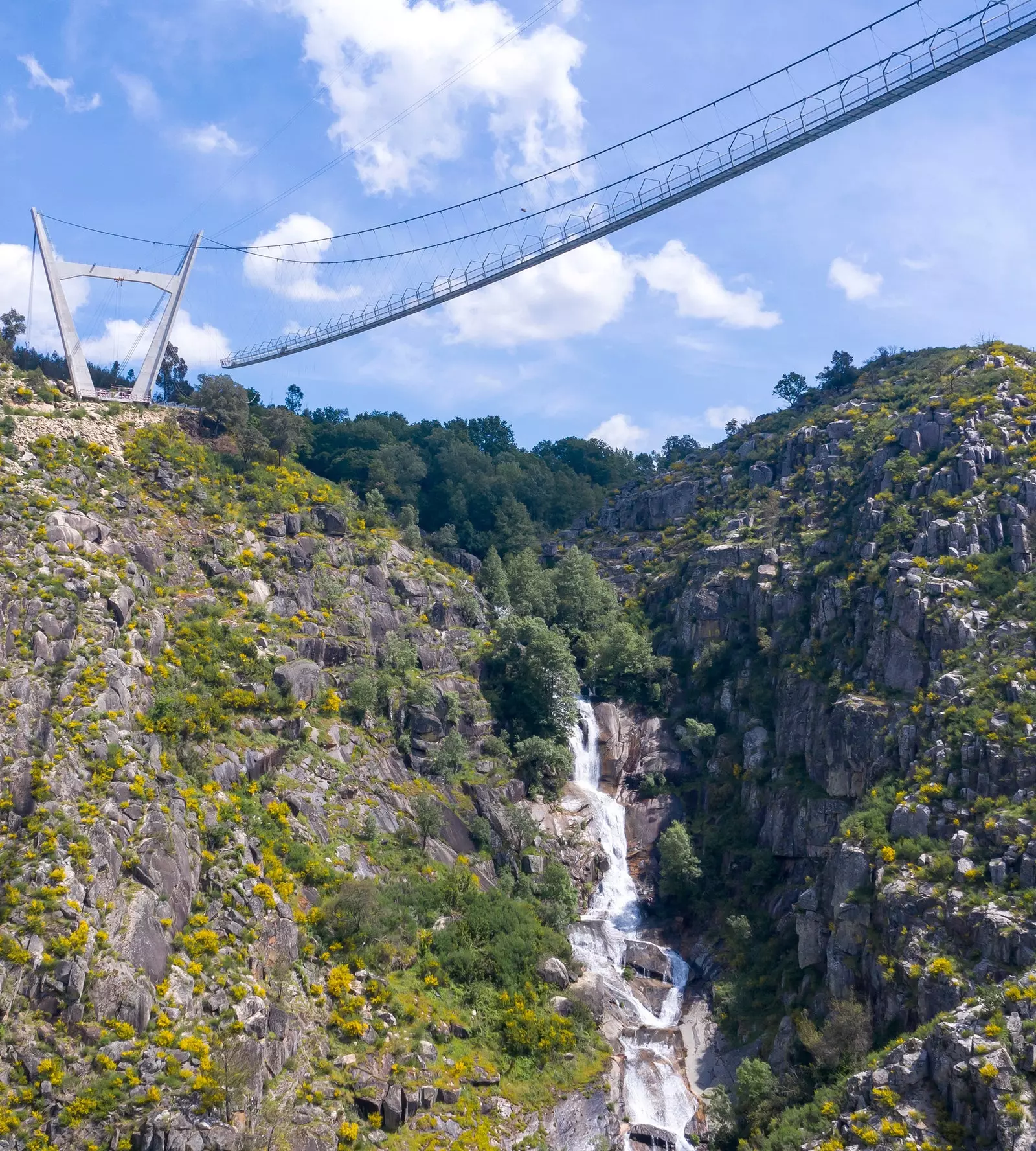
175 meters separate the center of the bridge from the ground. Who said vertigo?
WALKING OVER THE ABYSS OF PAIVA
The walkways of Paiva are located in one of the areas of greatest natural interest in Portugal: the Arouca Geopark . With an area of 328 km2, the Geopark is an open-air geological museum, with 41 registered geosites where numerous fossil deposits can be seen, such as the giant trilobites of Canelas and the ichnofossils of the Paiva Valley . But the Geopark is not only history and archeology, it is also adventure and hiking. And this is where it shines paiva river canyon.
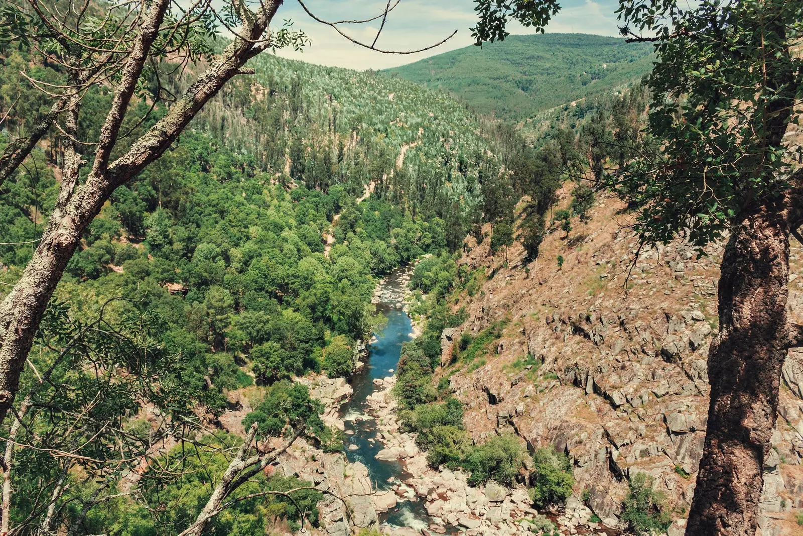
The views of the Paiva river from one of the trails
The Paiva waters They are not for beginners: that is what many of those who come to practice rafting in its numerous whitewater rapids, especially the point called Gola do Salto, the most accentuated of the entire Paiva with a drop of four meters, verify each year. This point is what they observe, just 40 meters away and with a mixture of fear and envy those who choose to explore the canyon in a more relaxed way through its hanging walkways: the footbridges (Passadiços , in Portuguese) of the Paiva.
Passadiços del Paiva, do you dare?
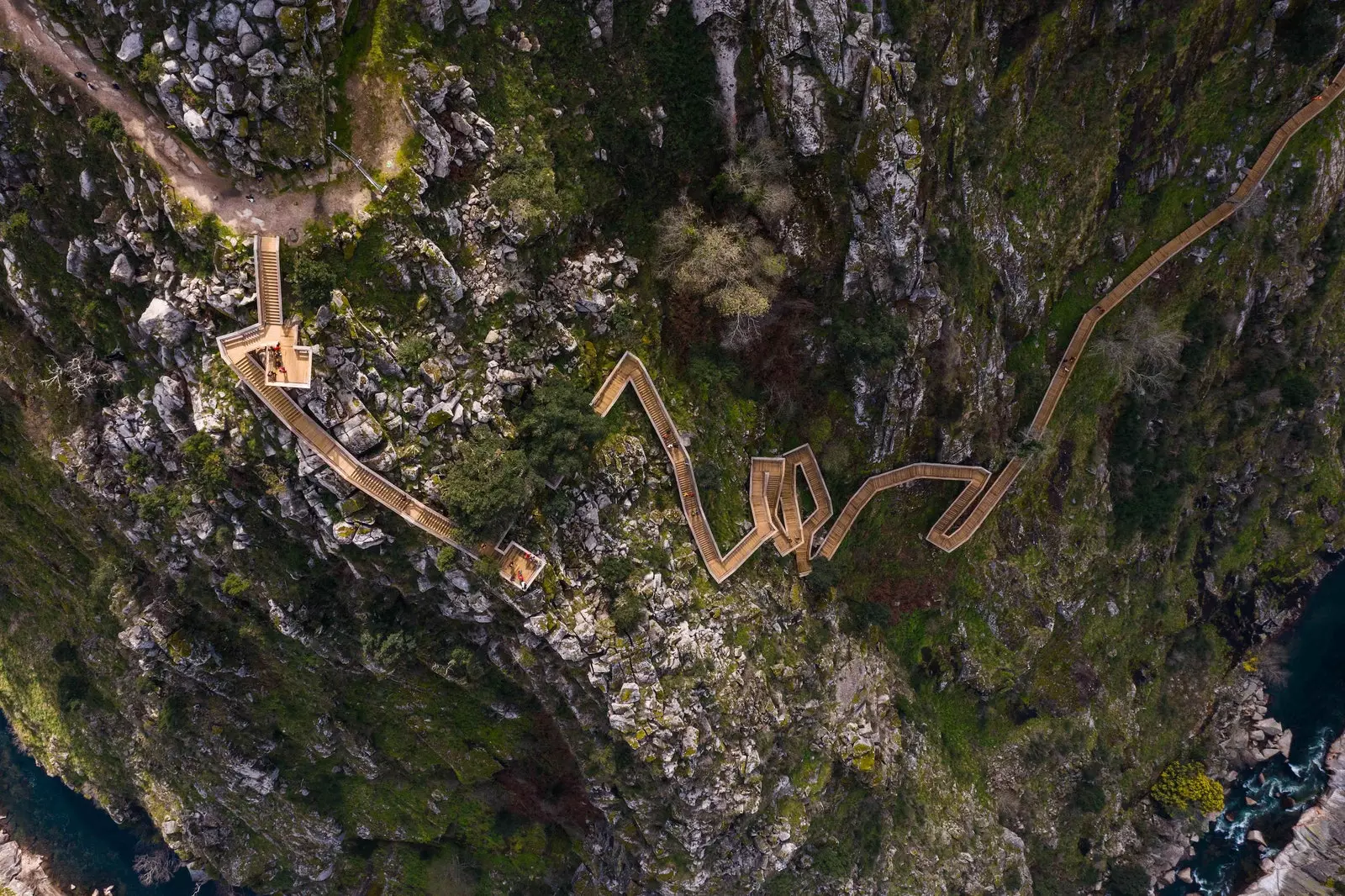
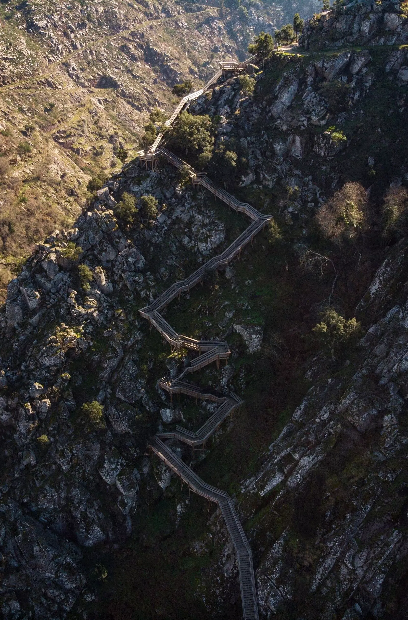
The Paiva footbridges extend between the fluvial beaches of Areinho and Espiunca in a linear path 8700 meters . The route can be done in two ways: round trip or, for the lazy (or tired), in one direction returning to the starting point in tourist taxis (some they are more safari jeeps than actual utility vehicles ) that remain in a constant oscillation throughout the day. Depending on whether the route is done in one or both directions, the starting point will vary depending on the location of the hardest section of the route: an imposing ascent that is located one kilometer from Areinho and in which you have to overcome a drop of more than 200 meters to blow of gluteus, triceps and handrails.
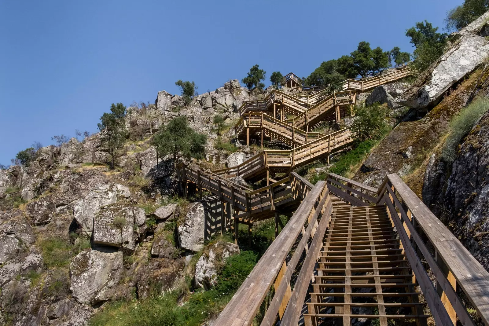
Infinite stairs through brutal rugged landscapes in Paiva
If you decide to take Areinho as a starting point to get rid of the hot flash of the climb as soon as possible, the reward will be immediate: one of the best panoramic views of the entire route . And with a guest of honor: the acrobatic 516 Arouca that hangs, inert, 175 meters above the river and accompanies one of the first landmarks of geological interest on the route: the Aguieiras river waterfall . This waterfall plunges over the Paiva through a set of slopes that add up to a total of 160 meters of fall.
From this point, the path drops steeply into the jaws of the canyon in countless steps that tests the vertigo (and kneecaps) of the bravest and provides what will be the best photos of the tour. Reaching the middle part of the canyon wall, the path begins a progressive descent until it reaches a few meters from the Paiva, all this with the knife-cut granitic rock company and a growing flora of pines, chestnut trees and arborescent thickets.
In just 3 kilometers , the landscape undergoes a total metamorphosis (at least from the smallness of human eyes): from the Grand Canyon of Colorado that knotted our throats at the height of 516 Arouca, we have passed to a path in the Colombian jungle . We are halfway there and we have reached the dreamed Rivendell: a place of rest preceded by suspension bridges, lianas (in reality, ropes tied to the branches of the fraga chestnut trees) and a river beach, that of Vau, the perfect place to cool off.
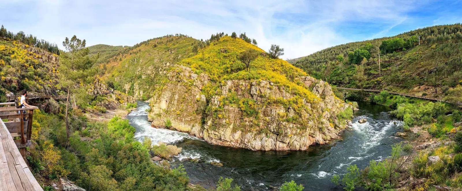
The 'Horseshoe Bend' of the Paiva
After the break, the path leaves the jungle and we return to the stark sun of the far west. In less than a kilometer, at the height of panel B6 of the route (which tells us about three species of native butterflies), we find ourselves, again, in Colorado: we are in front of the Horseshoe Bend of Paiva , a spectacular horseshoe-shaped meander that precedes the most desired place on the route for adrenaline junkies: the aforementioned Gola do Salto . This slope, the steepest of the entire river, shakes and shakes the rafting rafts like corks of vinho verde, evoking that scene from the mythical Fitzcarraldo by Werner Herzog in which the steamboat hurtled down the rapids of the Pongo.
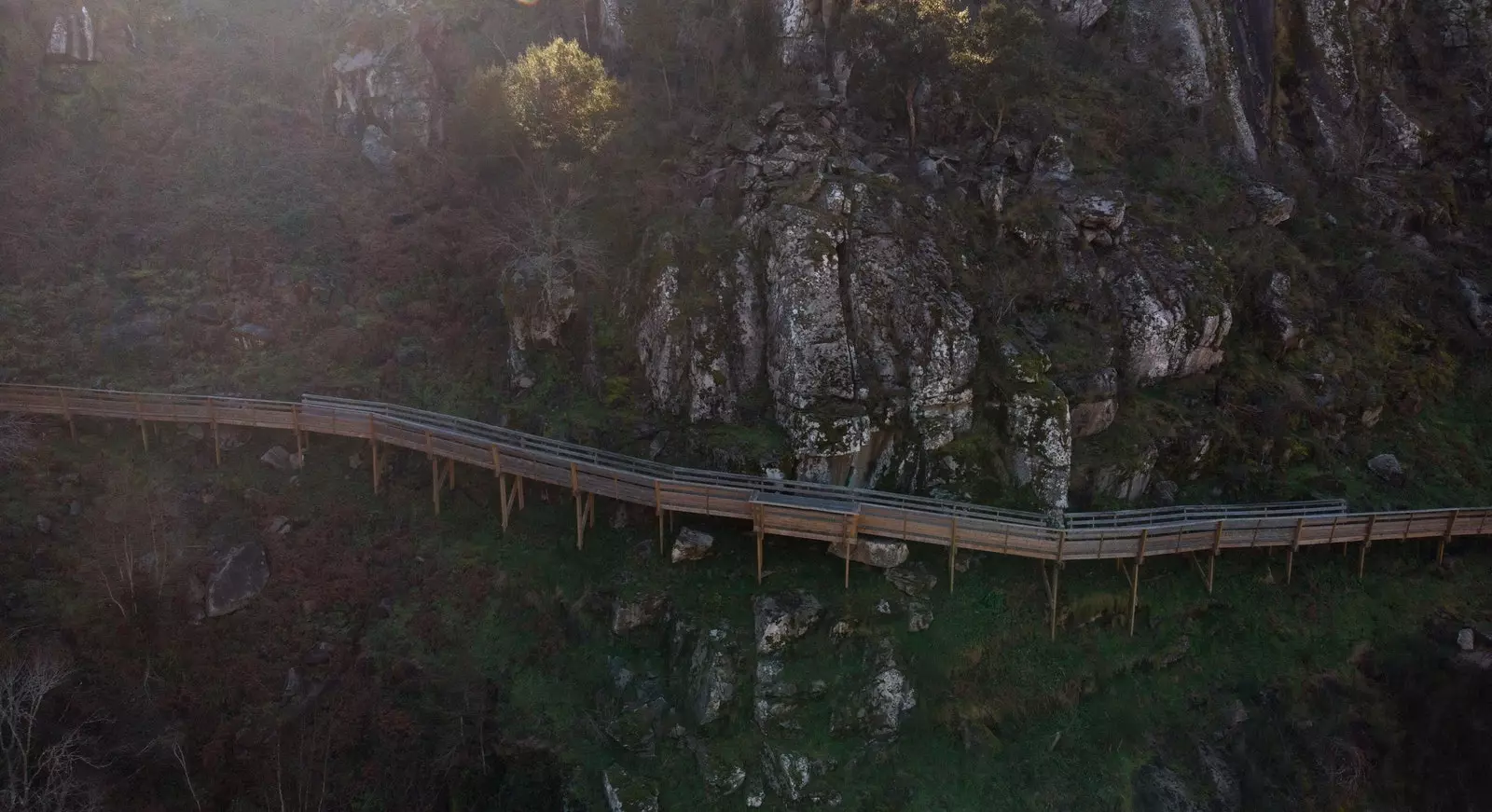
Once the rapids have been overcome, all that remains is to let yourself be carried along the footbridge in a gentle descent to the Espiunca river beach , where some tables and a small kiosk serve as a final rest (or intermediate, if you want to do the eight kilometers back). Gone are the two hours spent on the route and the feeling of having traveled a path that is simple in appearance but incredible if you look at the engineering of its layout: a platform that floats over the abyss for 8 kilometers and with direct views of the geological past of the region.
A true conquest of the impossible.
A true conquest of the impossible
SUBSCRIBE HERE to our newsletter and receive all the news from Condé Nast Traveler #YoSoyTraveler